ATTRIBUTION: This page provides attribution for maps and images included on this website. Maps direct to interactive maps with adjusting views.
How to Navigate: Click a topic below to jump to that Section. You can immediately return here by clicking any Section Heading or Return to Table link, or click fack-law.com to return to home page.
The History section includes the historical maps used on the site and additional maps to add depth to the historical timeline.
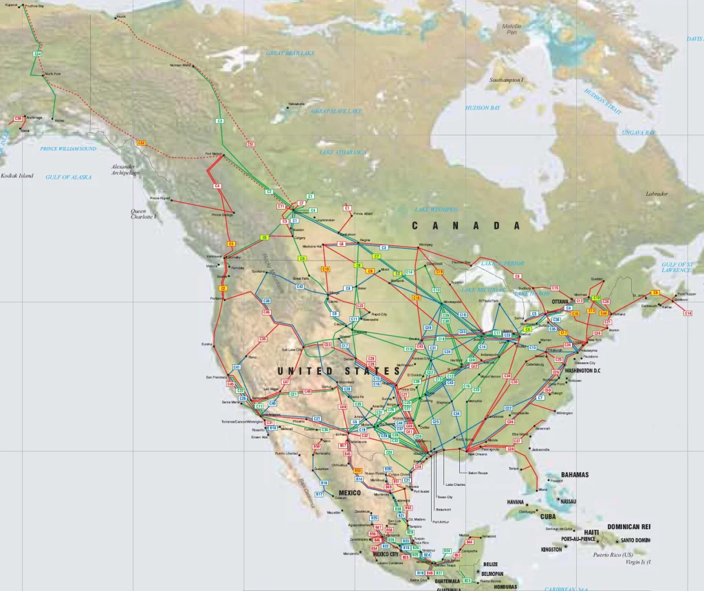
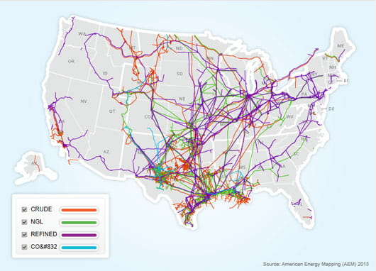
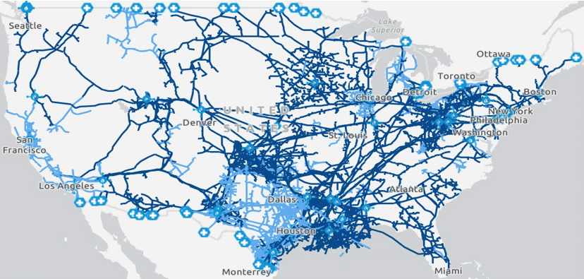
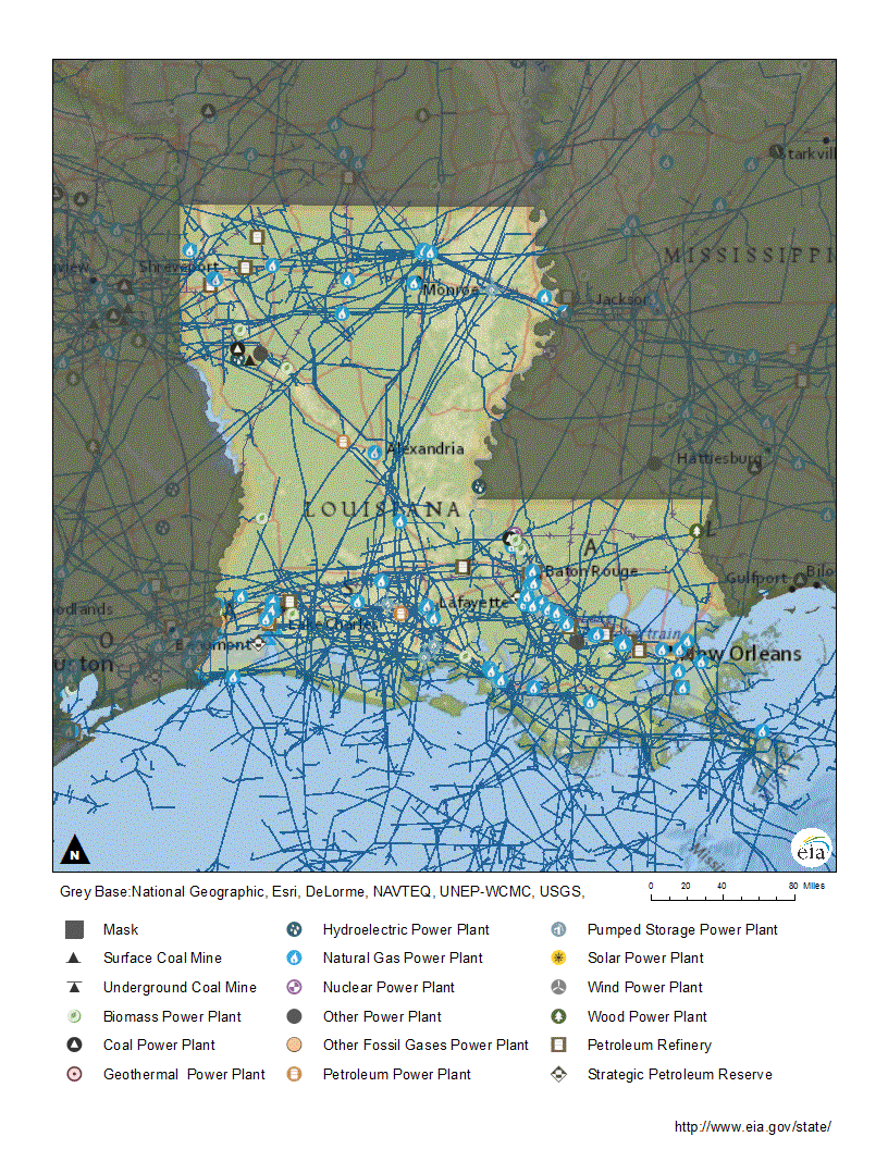
Courtesy of the U.S. Energy Information Administration.Map of North American Petroleum and Natural Gas Pipelines courtesy of theodora.comCourtesy of U.S. Energy Information Administration.Map of U.S. Liquid Pipelines courtesy of the American Petroleum Institute.
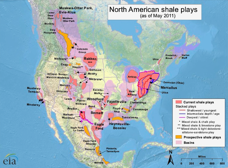
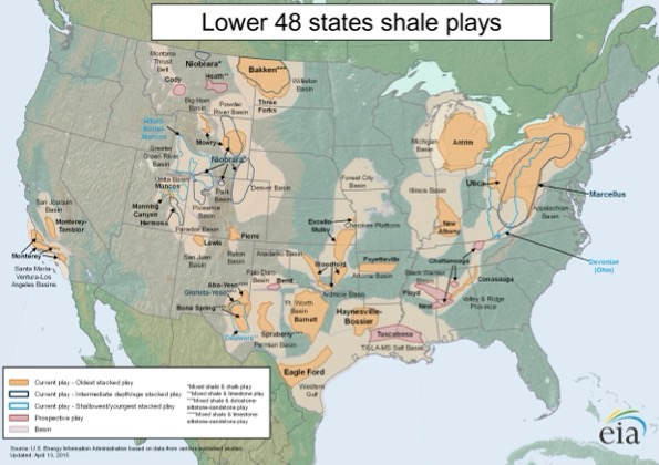
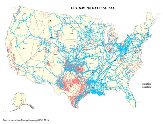
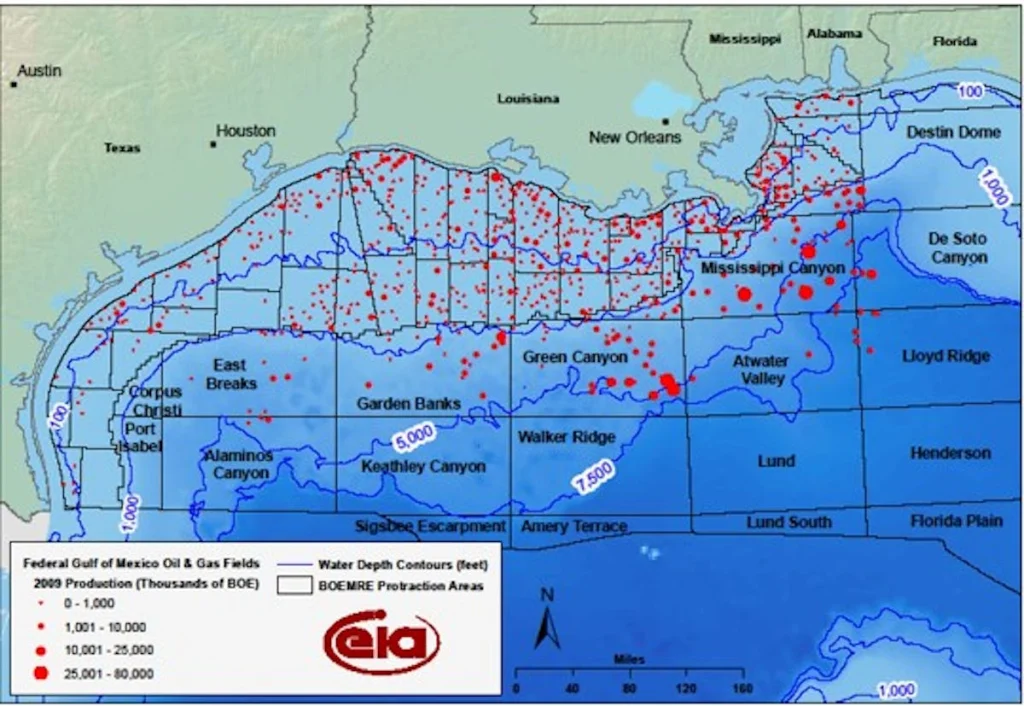
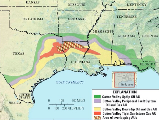
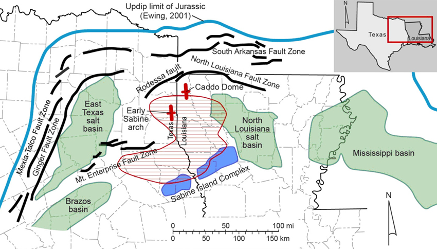
Courtesy of the U.S. Energy Information Administration.Map of the U.S. Natural Gas Pipelines courtesy of American Petroleum Institute.Map of Gas Production in Offshore Fields, Lower 48 States courtesy of the Energy Information Administration.Federal Gulf of Mexico Oil and Gas Fields, 2009 production courtesy of Offshore-mag.comUndiscovered resources by USGS in Cotton Valley Group courtesy of the Oil and Gas Journal
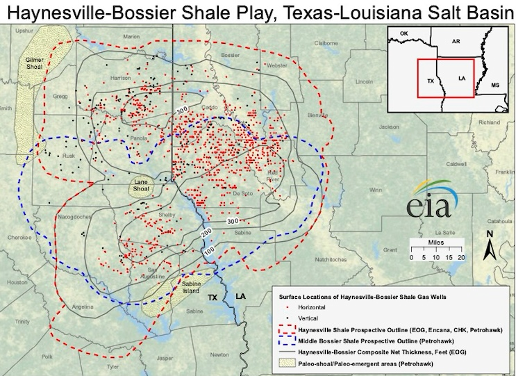
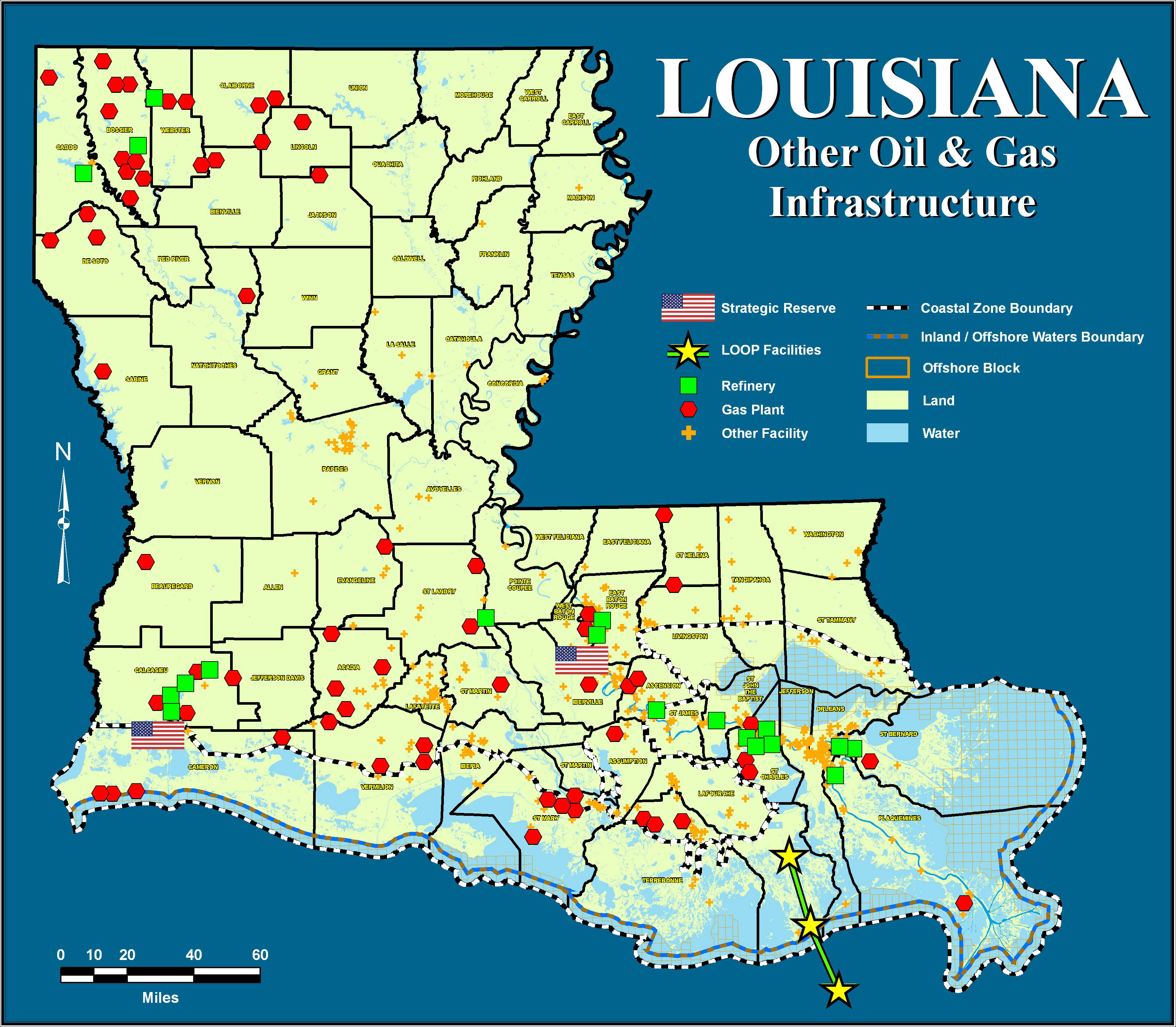
Map of Haynesville-Bossier Shale courtesy of the U.S. Energy Information AdministrationMap of the Haynesville Shale courtesy of the State of Texas Advanced Resource Recovery.Map of Louisiana pipelines courtesy of Energy Information Administration.Louisiana Other Oil & Gas Infrastructure courtesy of the Louisiana Department of Natural Resources.
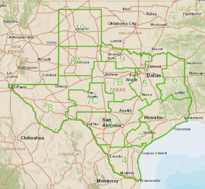
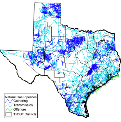
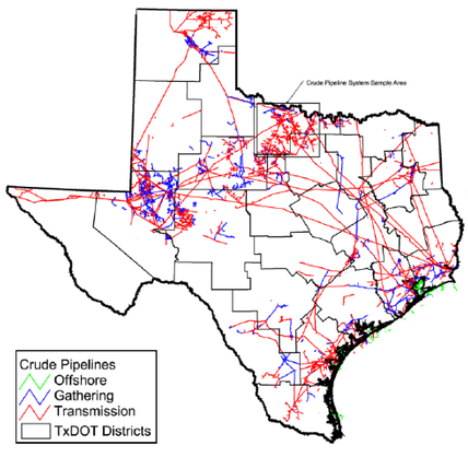
Map of Texas Natural Gas Pipelines courtesy of the Texas Department of Transportation and ResearchGate.Map of Texas Crude Pipelines courtesy of the Texas Department of Transportation and ResearchGate.
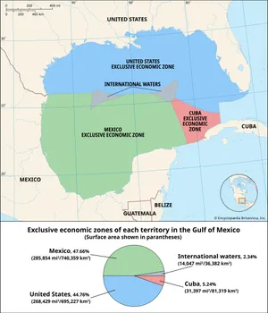
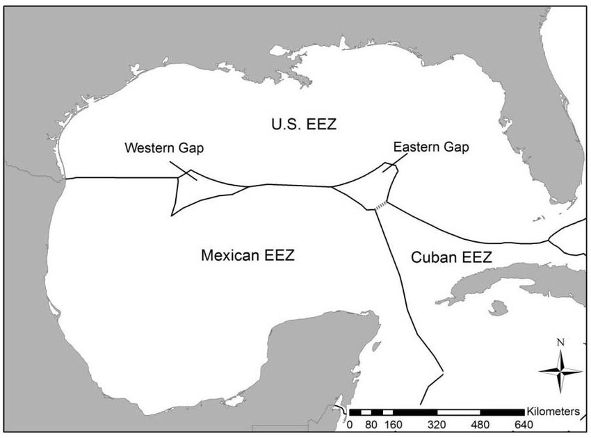
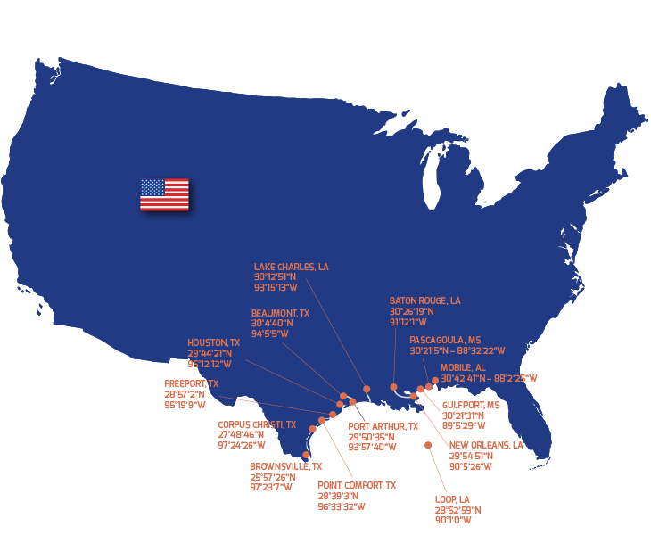
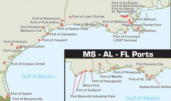
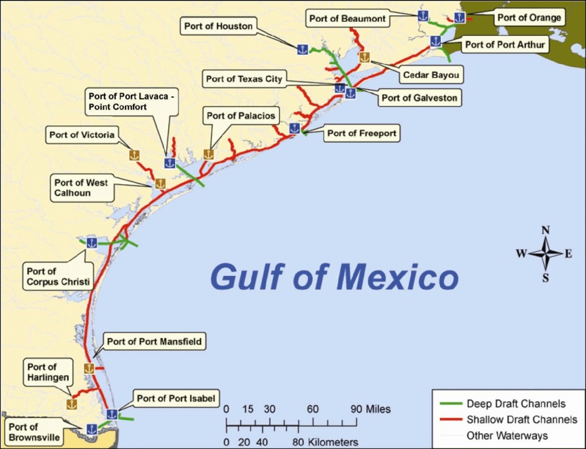
Map of the Exclusive Economic Zones in the Gulf of Mexico courtesy of Britannica.Map of the Gulf of Mexico Exclusive Economic Zones courtesy of ResearchGate.Map U.S. Gulf ports courtesy of Cockettgroup.Map of Texas, Louisiana, Mississippi, Alabama, and Florida ports courtesy of the American Journal of Transportation.Map of Texas deep draft ports courtesy of the Texas Department of Transportation and the Texas A&M Transportation Institute and ResearchGate.
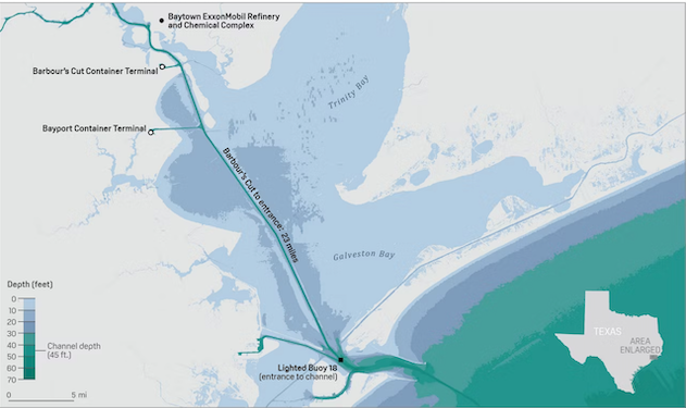
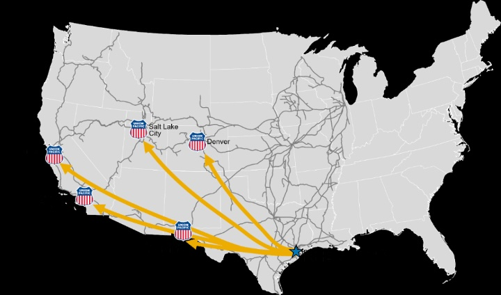
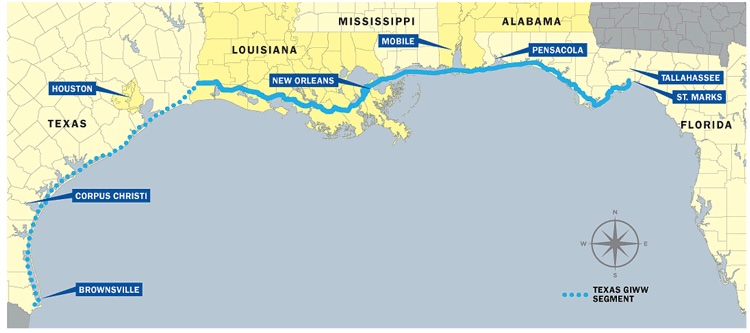
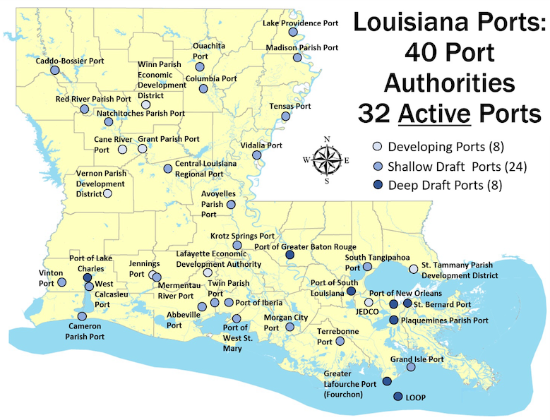
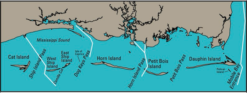
Map of the Houston Ship Channel courtesy of S&P Global Platts Analytics, NOAA NCEI.Map of rail road routes from the Port of Houston courtesy of the Port of Houston.Map of the Gulf Coast Intracoastal Waterway courtesy of the Texas Department of Transportation.Map of Louisiana Ports courtesy of Louisiana Department of TransportationMap of the Mississippi Sound courtesy of the Biloxi Shrimp Company.
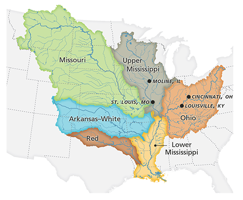
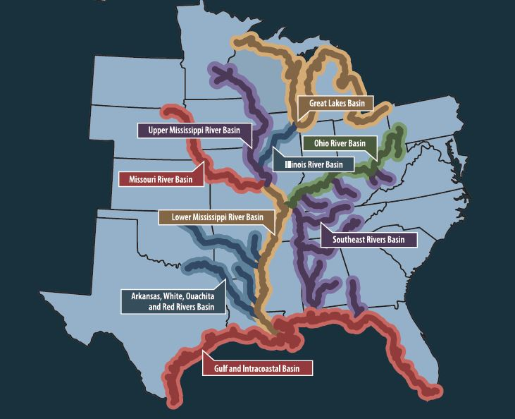
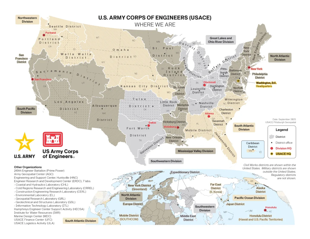
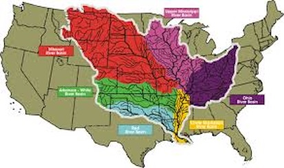
Map of the U.S. Inland Waterways and IRPT Basins courtesy of the Inland Rivers Ports & Terminals, Inc. – An Association.Courtesy of the U.S.A.C.E.Map of U.S.A.C.E. Mississippi River Commission courtesy of the U.S. Army Corps of Engineers..
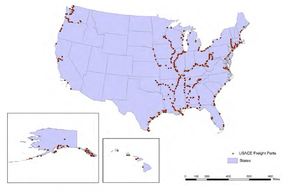
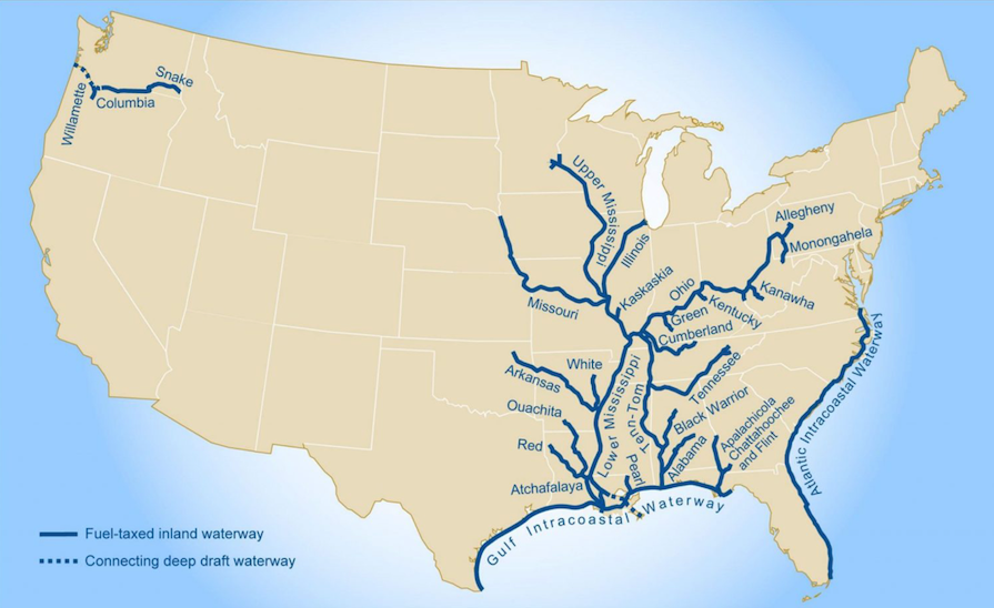
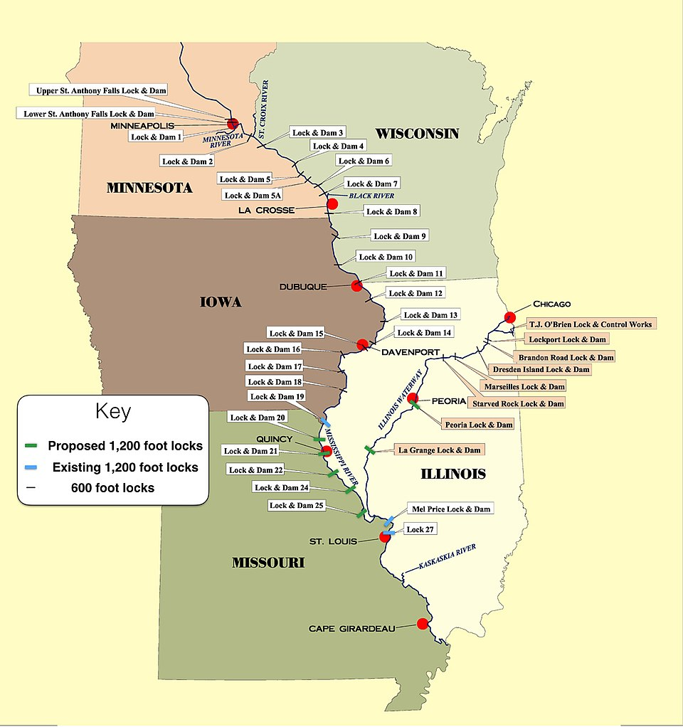
Map of Federal Commercial Ports courtesy of the Mid-America Freight Coalition.Map of the U.S. Inland Waterway courtesy of wikipedia.Map of Fuel-Taxed Inland Waterways System courtesy of the U.S. Army Corps of Engineers, GAO, and U.S. Grains and Byproducts CouncilMap of the Upper Mississippi River Lock System courtesy of two-mississippi.com
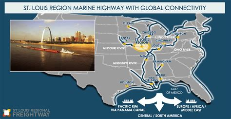
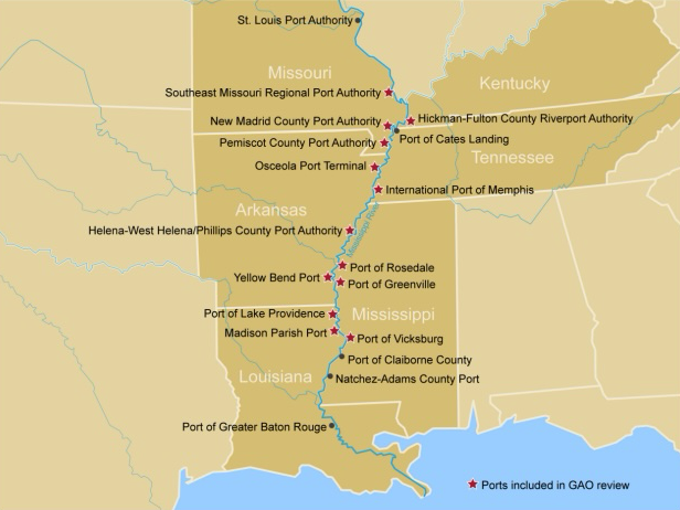
St. Louis Regional Marine Highway courtesy of the St. Louis Regional Freightway.Courtesy of Inland Rivers Ports and Terminals, Inc. – An Association.Courtesy of Inland Rivers Ports and Terminals, Inc. – An Association.Map of the Upper Mississippi Ports courtesy of U.S. Government Accountability Office.
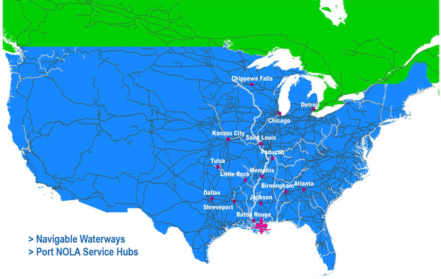
Courtesy of the Mid-Mississippi Development District.Map of Port of New Orleans Service Hubs courtesy of Port of New Orleans
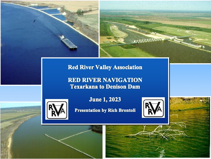
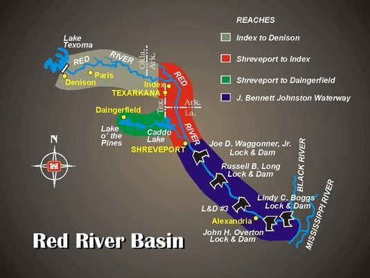
Red River Navigation from Texarkana to Denison Dam. Courtesy of the Red River Valley Association.Map of Red River Basin’s Navigable Waterway. Courtesy of the Red River Valley Association.
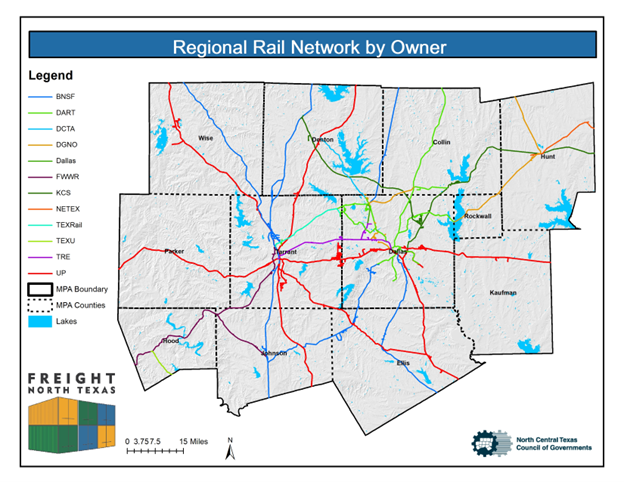
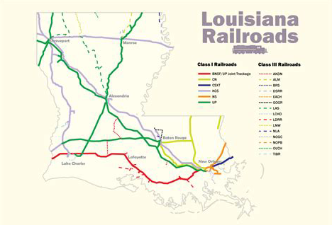
Map of North Texas Regional Rail by Owner courtesy of the North Central Texas Council of Governments.Map of Louisiana Railroads courtesy of the Louisiana Department of Transportation.
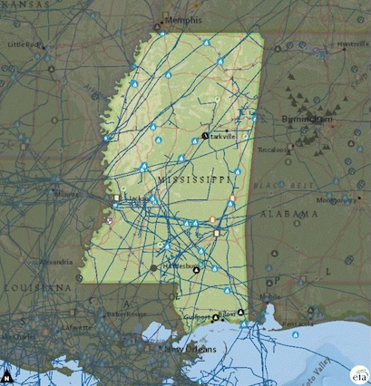
Mississippi Railroad Map
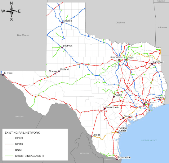
Map of Texas Existing Rail Network courtesy of the Texas Department of Transportation.
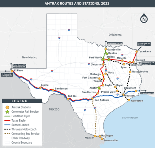
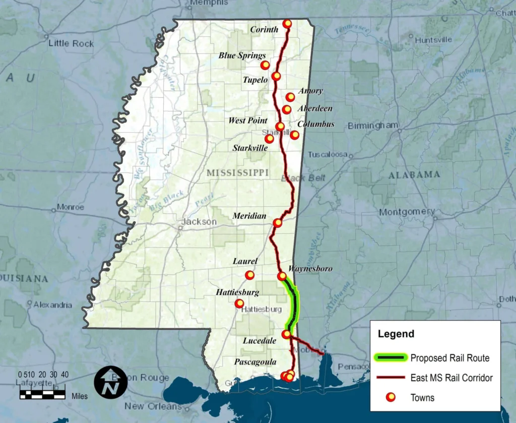
Amtrak Routes and Stations in Texas courtesy of the Texas Department of Transportation.Proposed Rail Road connector in Southeast Mississippi. Courtesy of the Rail Authority of East Mississippi.
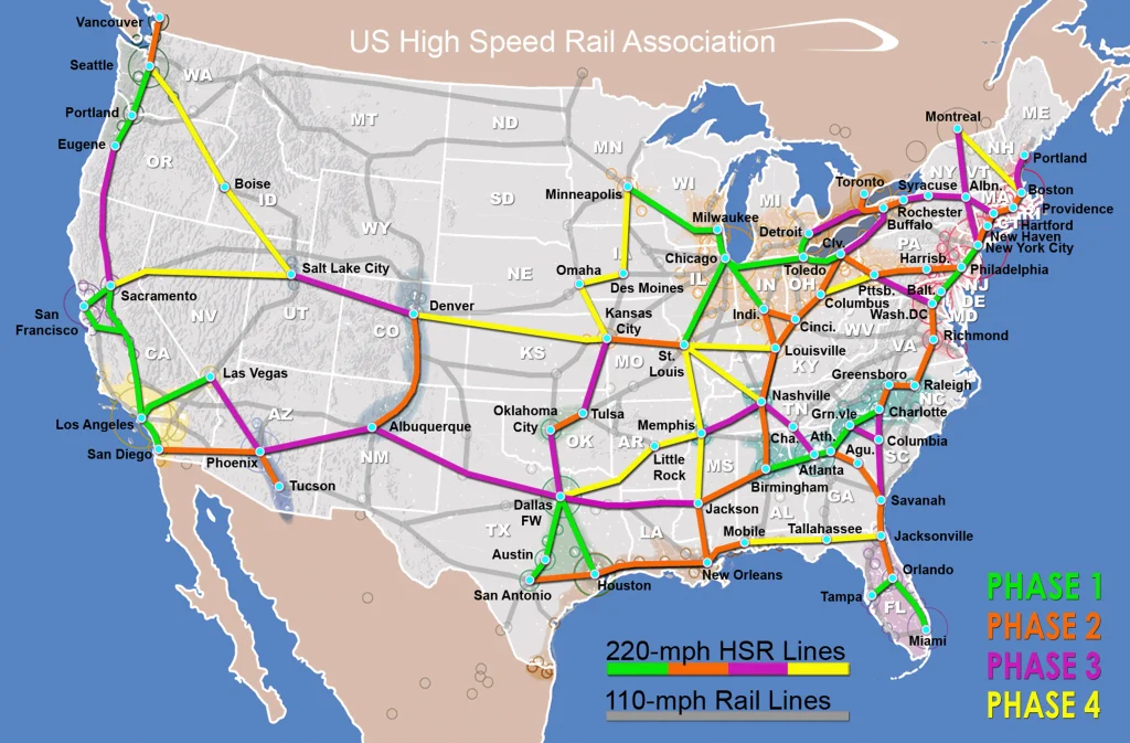
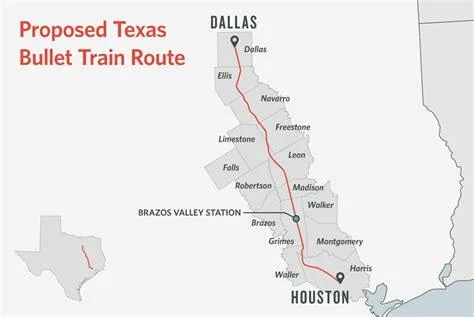
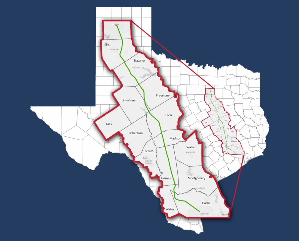
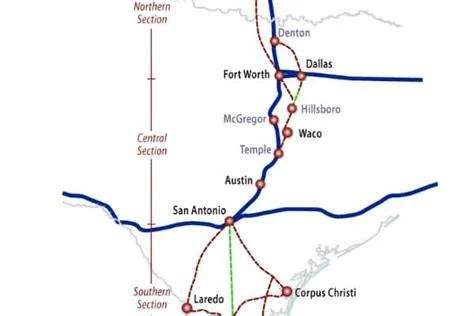
National HSR Network courtesy of the U.S. High Speed Rail Association.Texas Central High Speed Rail courtesy of Texas Central.Texas Central High Speed Train Alignment Map courtesy of Texas Central.South Central Texas High Speed Rail courtesy of the High Speed Rail Alliance.
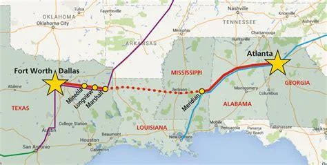
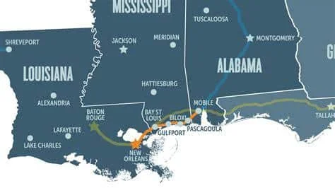
Interstate 20 Corridor Long Distance Railroad courtesy of the Interstate 20 Corridor Council.Courtesy of Southern Rail Commission.Courtesy Southern Rail Commission.
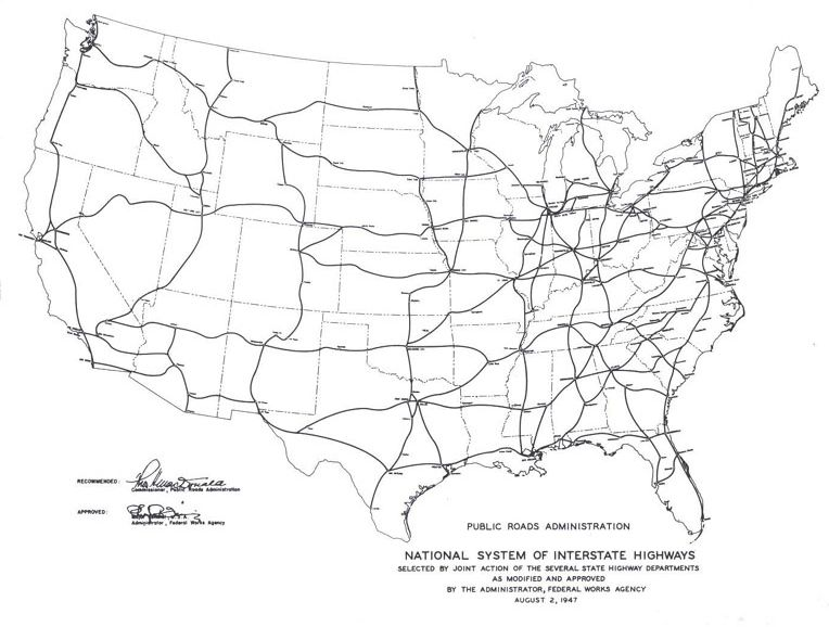
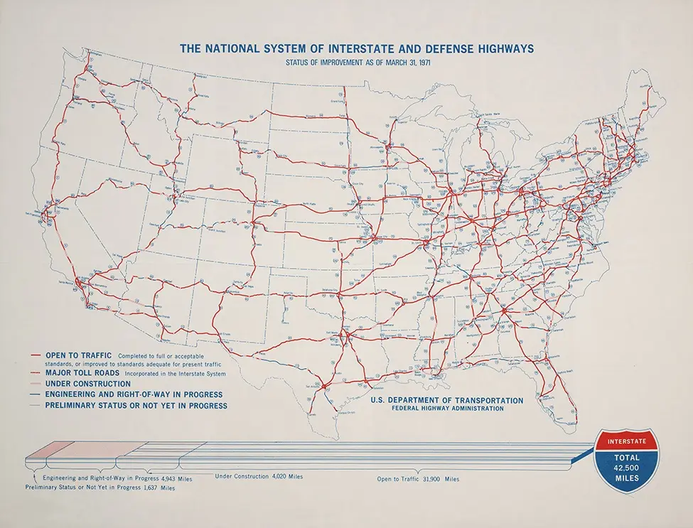
Map of the Nation System of Interstate Highways and Defense Highways, August 2, 1947 courtesy of the U.S. Department of Transportation, Federal Highway Administration.Map of the National System of Interstate and Defense Highways: Status of Improvements as of March 31, 1971, Washington: GPO, 1971 courtesy of the Linda Hall Library.
Map of the United States Interstate System courtesy of Printable World Maps.
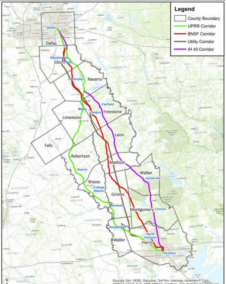
Map of the Interstate 45 utility corridor courtesy of the Courier of Montgomery County.
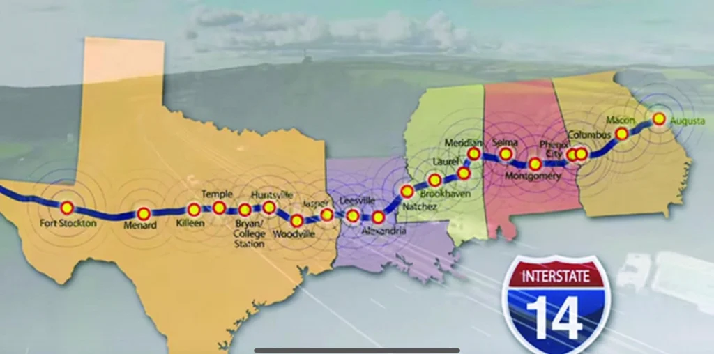
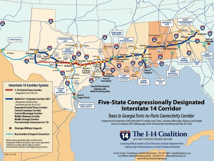
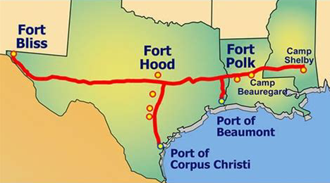
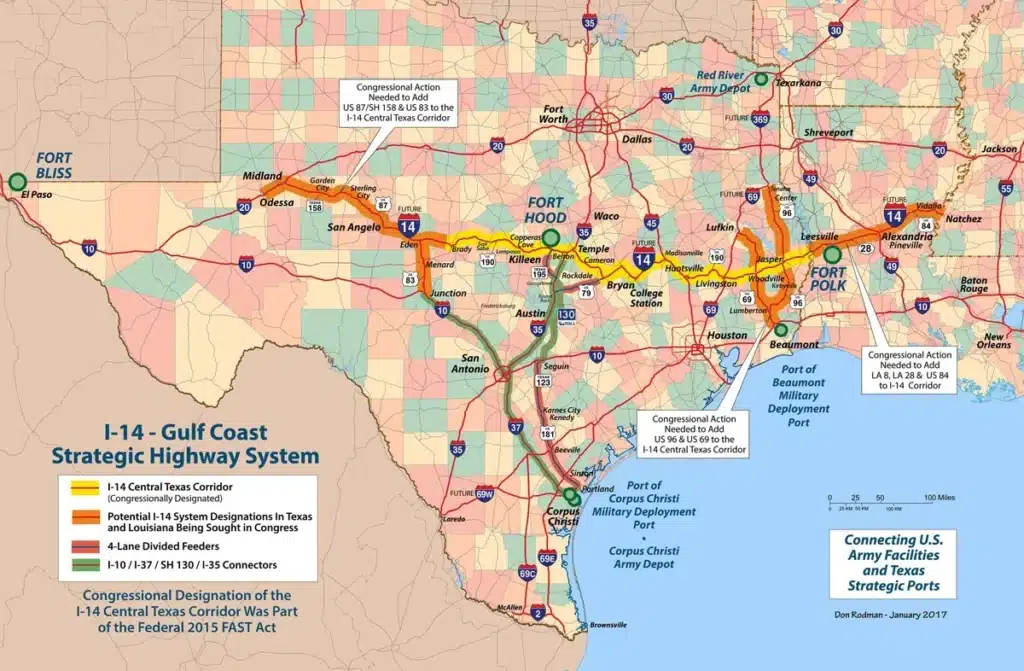
Map of the I-14 Gulf Coast Strategic Coast Highway courtesy of the I-14 Coalition, Gulf Coast Strategic Highway Coalition, Inc.Interstate 14 Strategic Coast Highway courtesy of the I-14 Coalition.Interstate 14 Strategic Coast Highway courtesy of the I-14 Coalition.Map of the I-14 Gulf Coast Strategic Highway courtesy of the I-14 Coalition, Gulf Coast Strategic Highway Coalition, Inc. Interstate 14 Strategic Coast Highway courtesy of the I-14 Coalition.
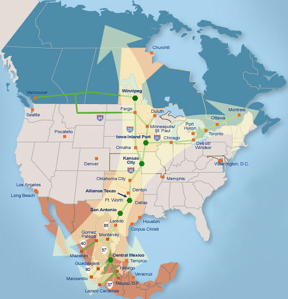
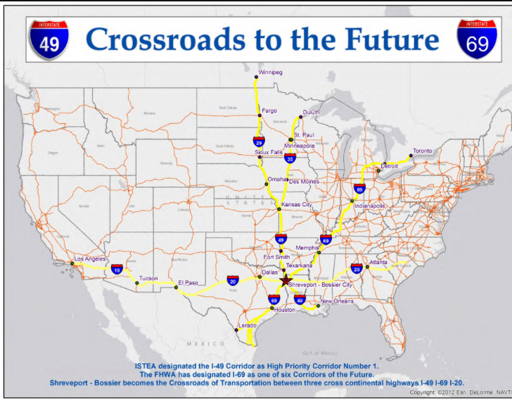
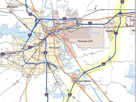
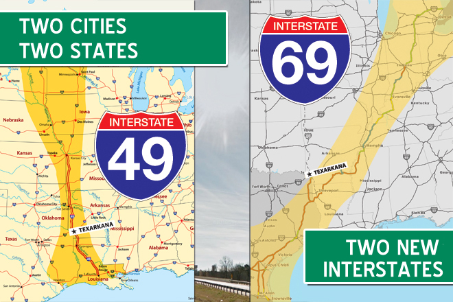
NAFTA Trade Route courtesy of NAFTA website.Map representing the Shreveport-Bossier transportation crosswords for I-49, I-69, and I-20 continental highways courtesy of Oconto County Plat Map.
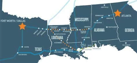
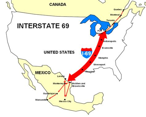
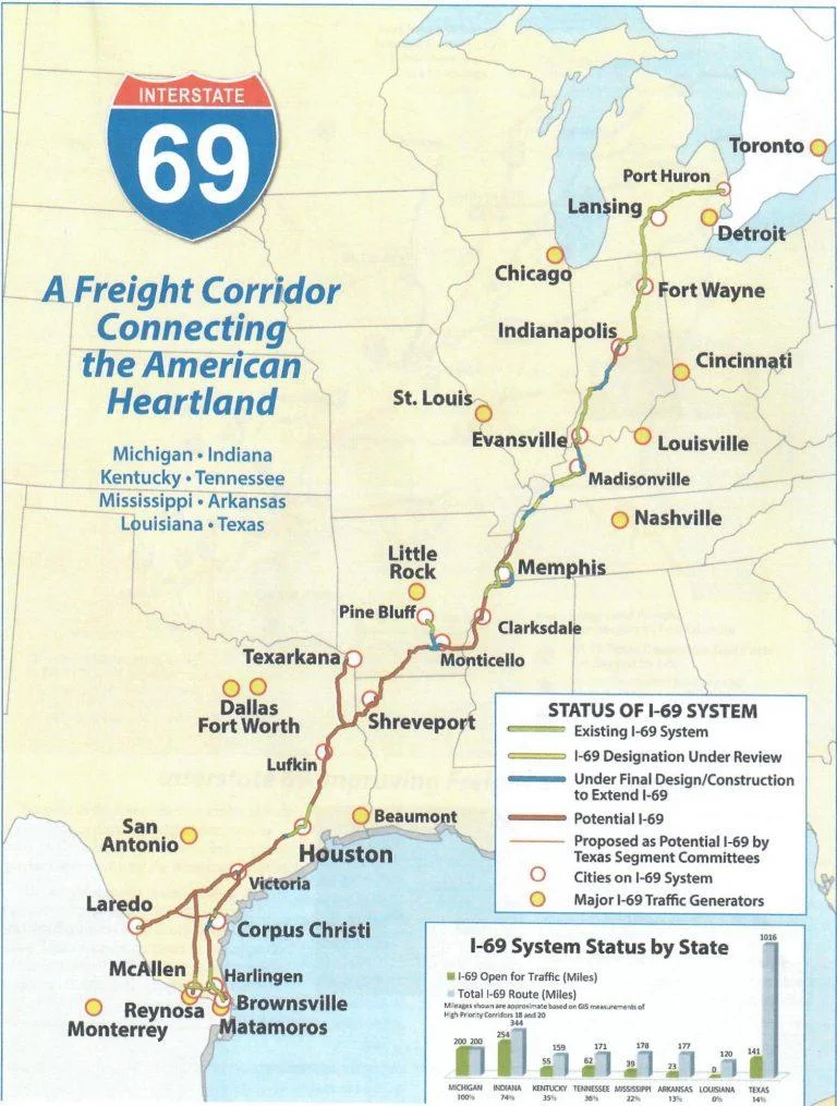
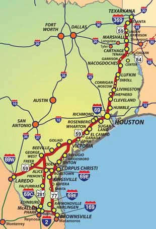
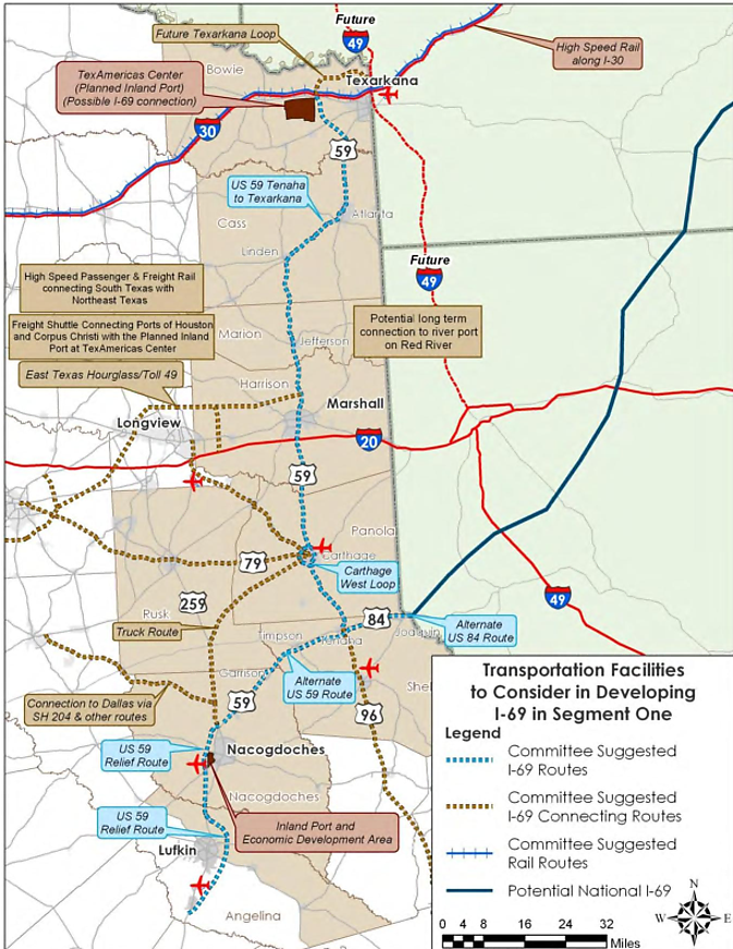
Interstate 69 NAFTA Super Highway. Courtesy of the Alliance for I-69 Texas.
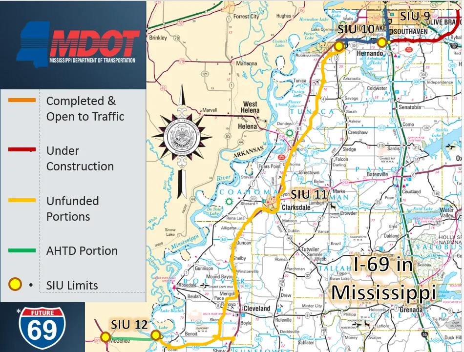
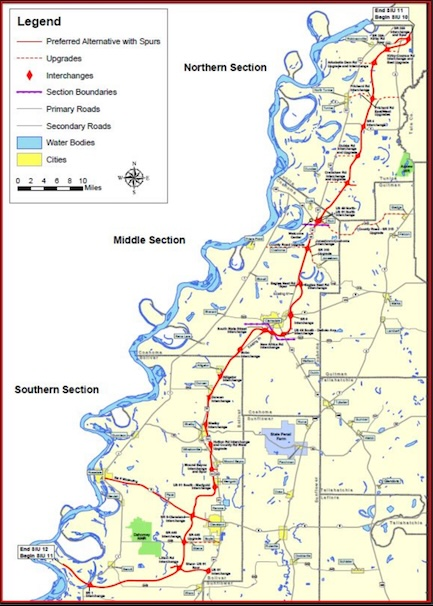
Interstate 69 NAFTA Super Highway – Mississippi Connector. Courtesy of the Mississippi Department of Transportation.Interstate 69 NAFTA Super Highway – Mississippi Connector. Courtesy of Mississippi Department of Transportation.
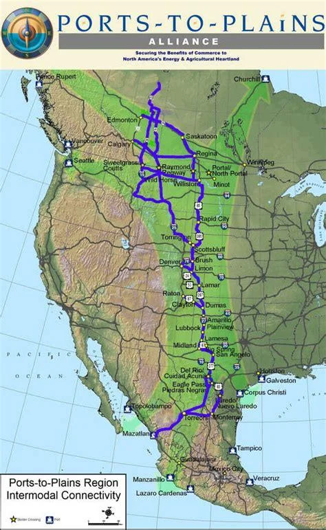
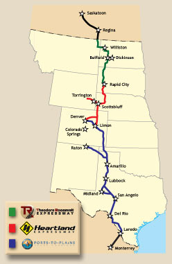
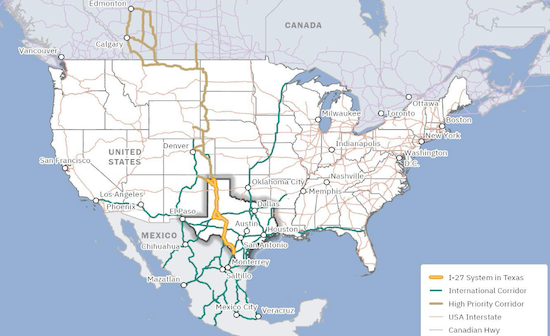
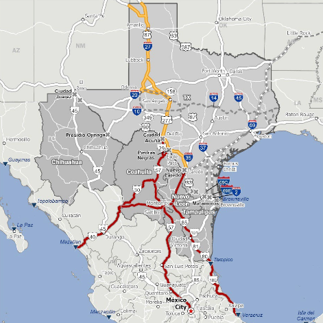
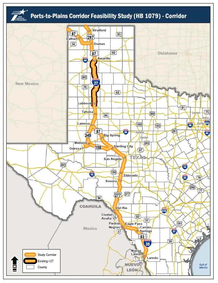
Interstate 27 Ports-to-Plains NAFTA Highway courtesy of the Port to Plains Alliance.
International map of I-27 Ports-to-Plains Highway courtesy of Plains-To-Plains Alliance.
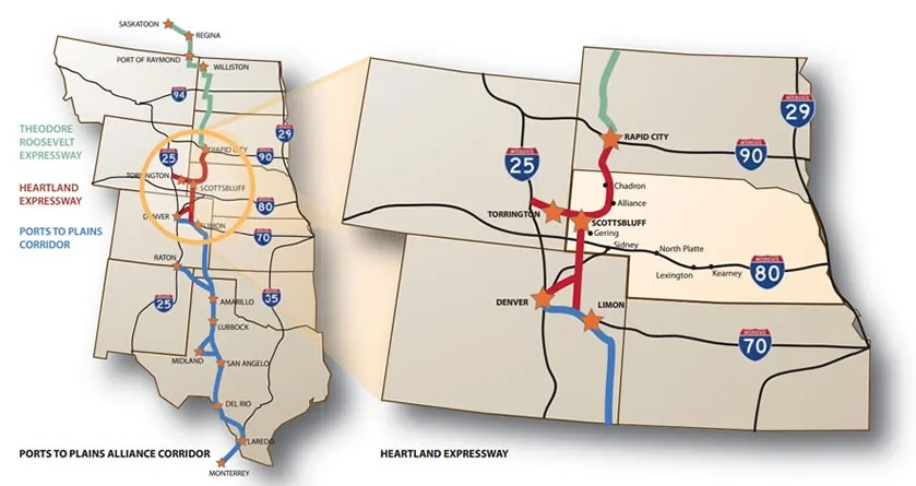
Map of the Heartland Expressway courtesy of the Heartland Expressway Association.Theodore Roosevelt Expressway courtesy of the Theodore Roosevelt Expressway Associaton
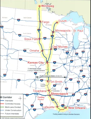
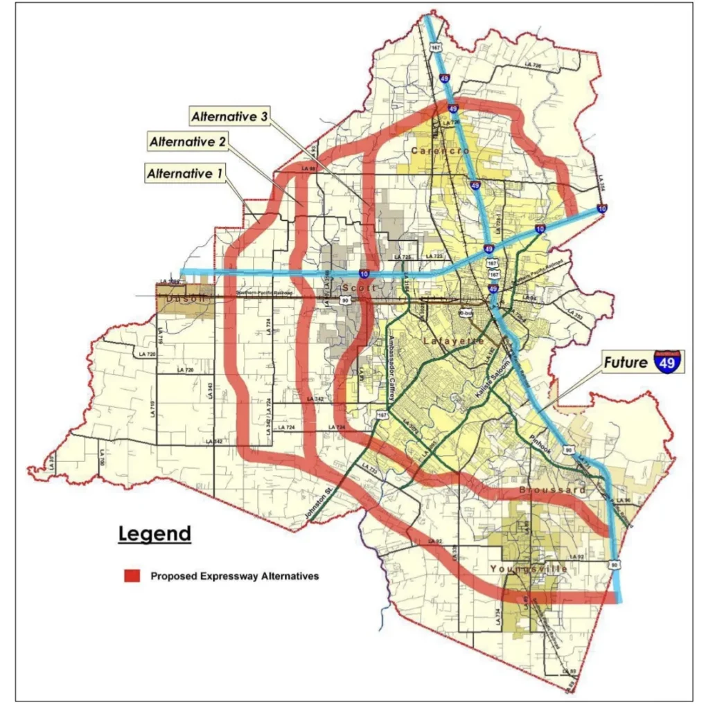
Maprepresenting the crossroads between I-49 and I-69 at Texarkana, Arkansas courtesy of the Arkansas Business Journal.Interstate 49 Shreveport to Texarkana Connector courtesy of the Northwest Louisiana Council of Governments.
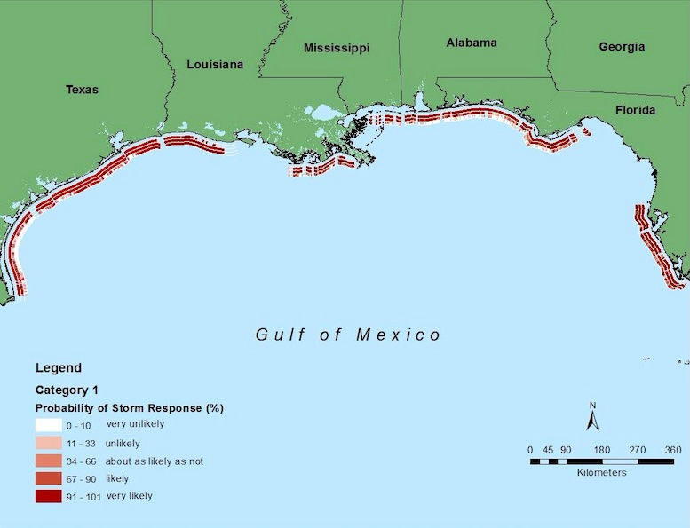
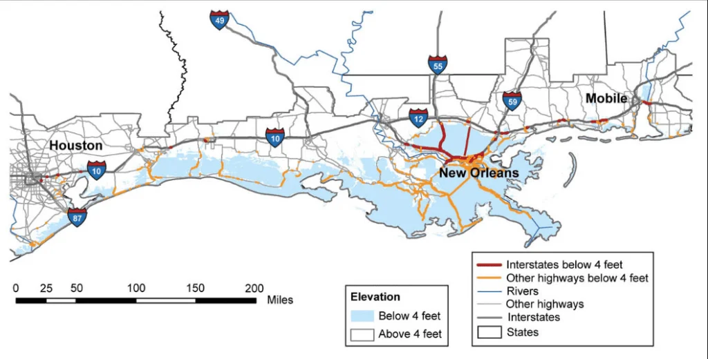
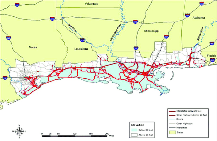
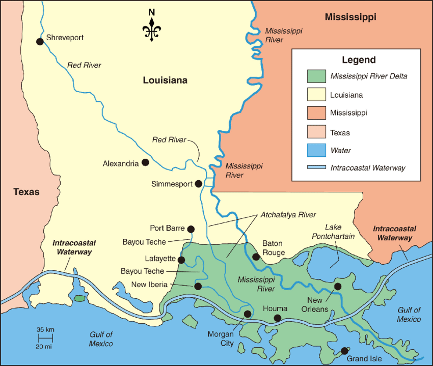
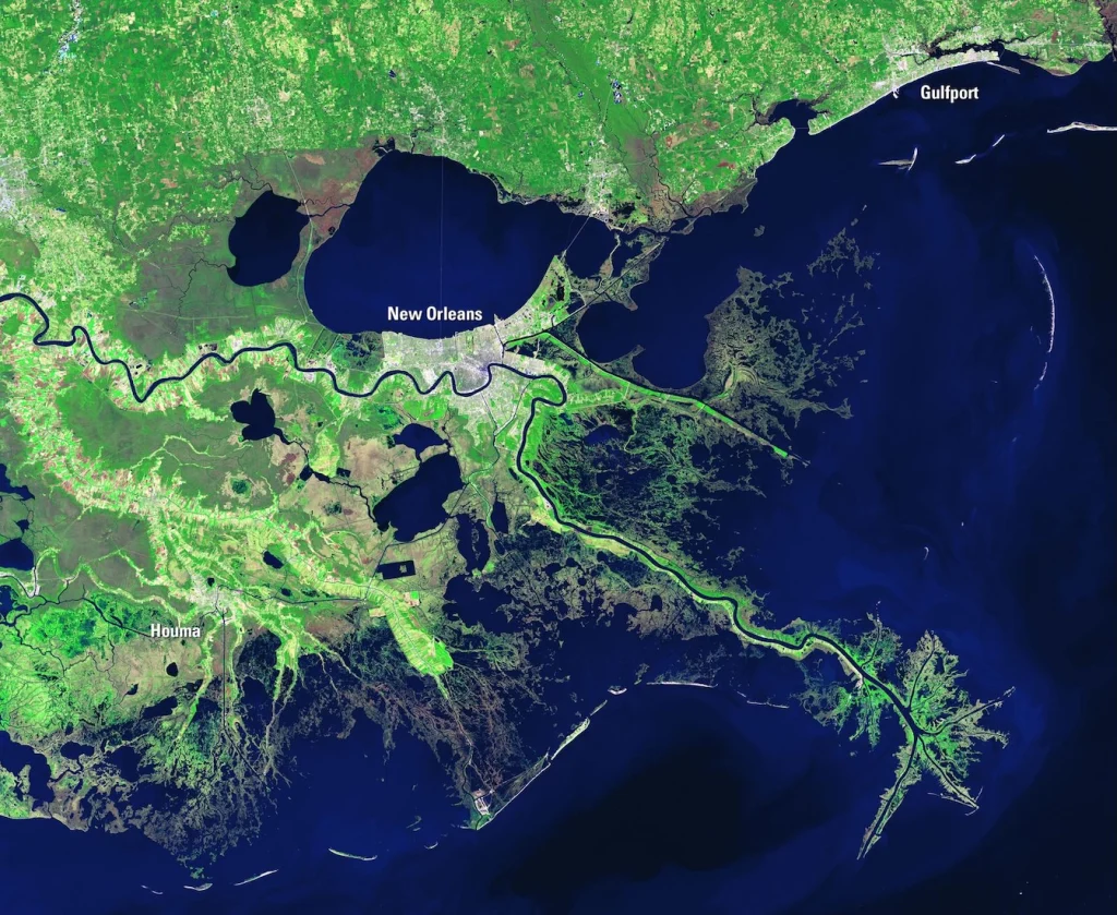
Map of the National Assessment of Hurricane-Induced Coastal Erosion Hazards: Gulf of America Update courtesy of the Department of Interior.Map of major roadways that could be permanently flooded by seat level rise in the next 50 to 100 years courtesy of the U.S. Environmental Protection Agency.Map of Gulf Coast Highways at Risk from Storm Surge at Elevations currently below 7.0 meters (23 ft.) courtesy of the U.S. Climate Source Program Synthesis and Assessment Products and Researchgate.Map of the Mississippi River Delta courtesy of ResearchGate.The Mississippi River Delta Basin courtesy of the United States Geological Survey.
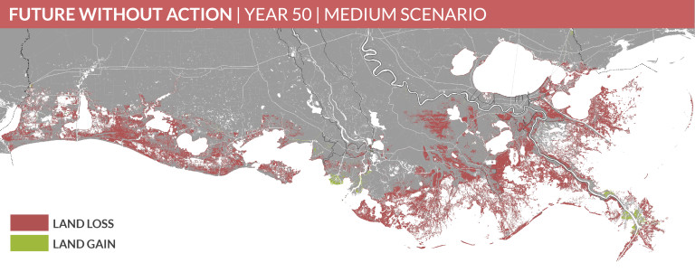
A Changing Landscape: Future Without Action|Year 50| Medium Scenario courtesy of the Coastal Proection and Restoration Authority.
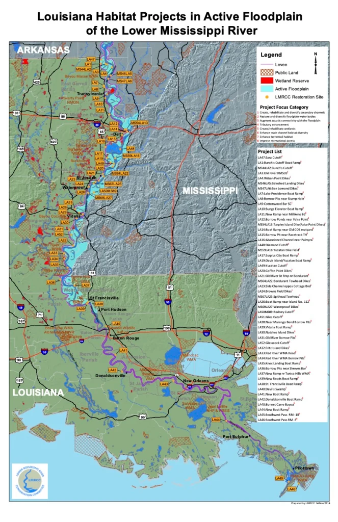
Map of the Louisiana Habitat Projects in Active Floodplain of the Lower Mississippi Floodplain courtesy of the Lower Mississippi River Conservation Committee.
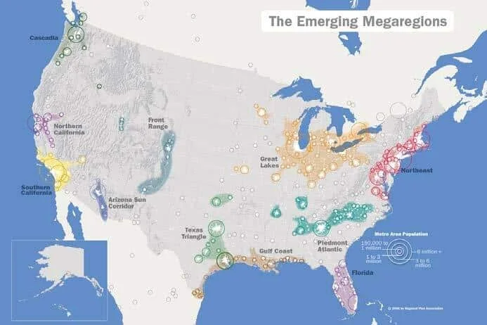
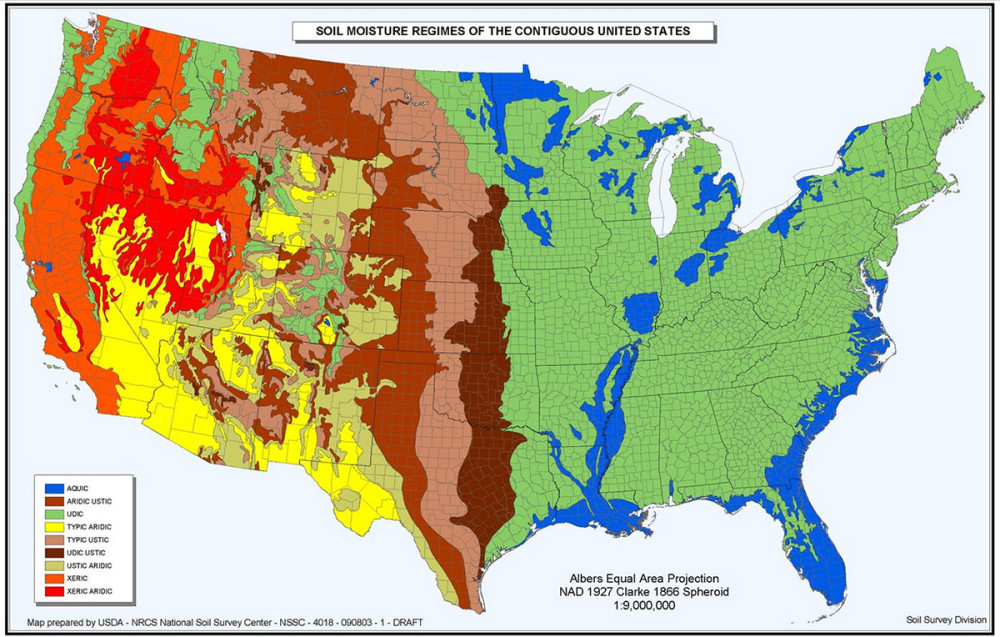
United States Emerging Mega-Regions courtesy of Regional Planning Association.Map of the Soil Moisture Regimes of the contiguous United States courtesy of the SoilPortal.United States – Mexico – Canada Agreement (U.S.M.C.A.) courtesy of the U.S. Government.
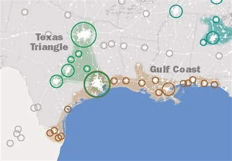
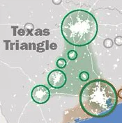
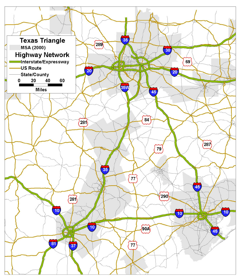
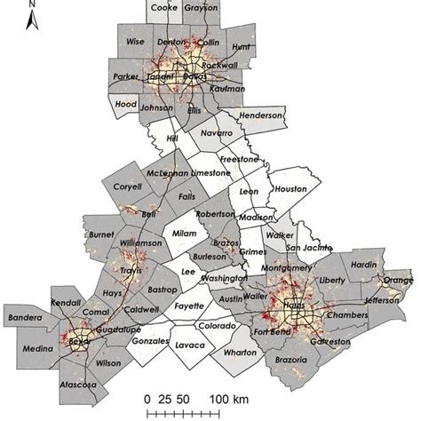
The Texas Triangle courtesy of the Regional Planning Association.The Texas Triangle courtesy of mdpi.com and resarchgate.netThe Texas Triangle courtesy of mdpi.com and resarchgate.net
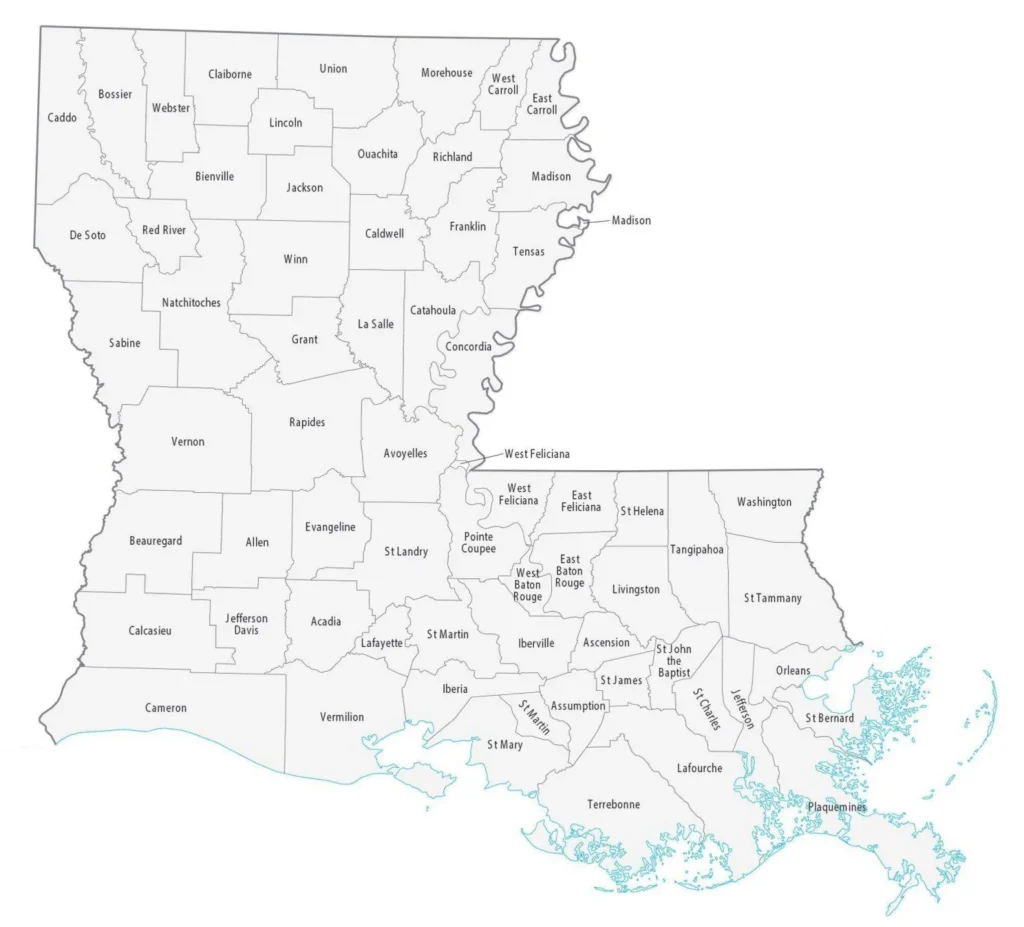
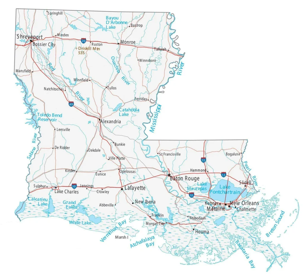
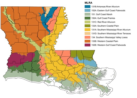
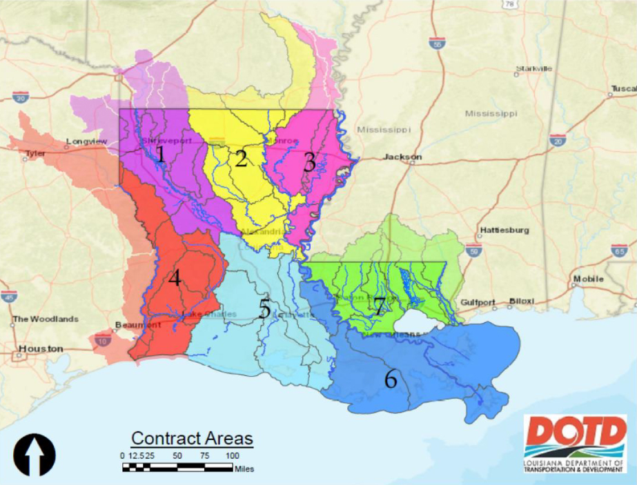
Louisiana State Capital courtesy of Wikimedia.Louisiana Parish Map courtesy of GISGeography.Map of Louisiana – Cities and Roads courtesy of GISGeography.District Map courtesy of the Louisiana Association of Planning and Development Districts.Map of an Overview of Louisiana Soils courtesy of Louisiana State AgCenter.
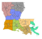
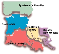
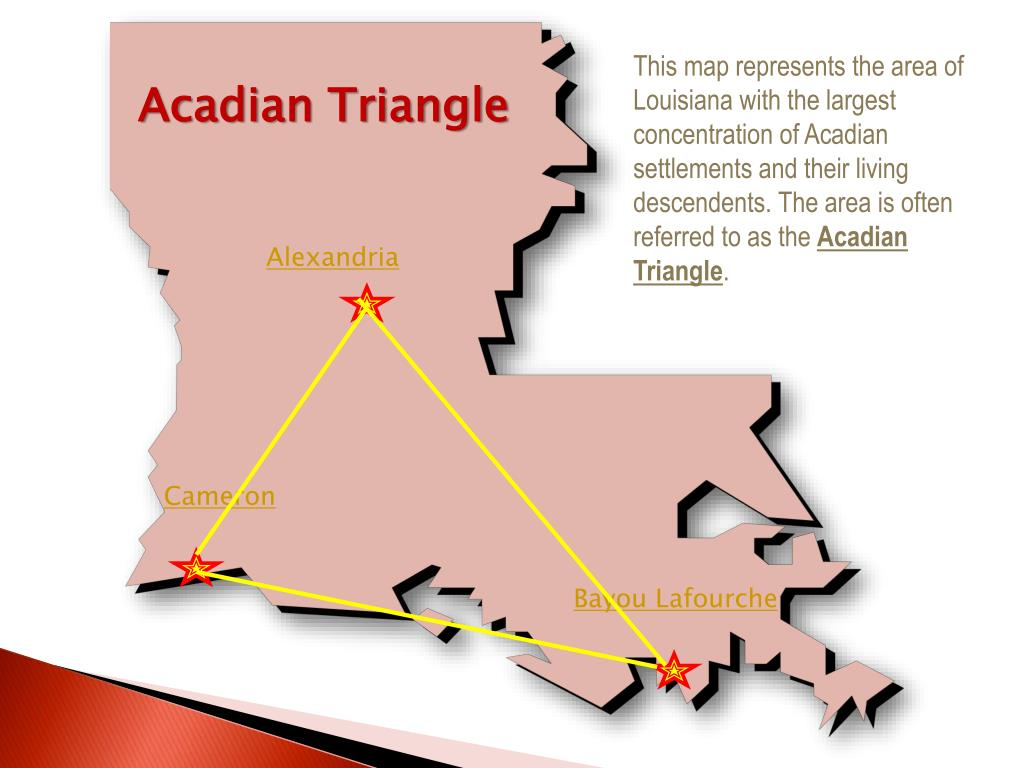
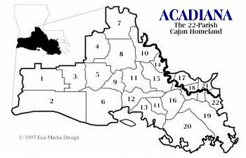
Map of State of Louisiana’s River Basins and Watershed courtesy of the Louisiana Department of Transportation and Development.Map of Cultural Louisiana courtesy of thecajuns.com and the State of LouisianaFlag of Acadiana courtesy of Acadian.orgThe Acadian Triangle courtesy of Italia Hanlye.Map of Acadiana courtesy of Acadian.org
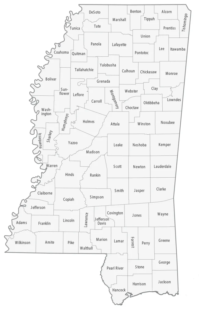
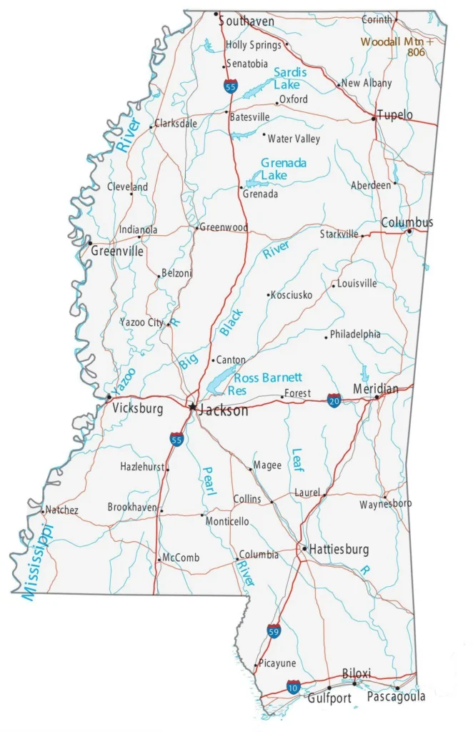
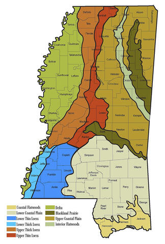
Mississippi State Capital Building courtesy of State of Mississippi.Mississippi County Map courtesy of GISGeography.Map of Mississippi – Cities and Roads courtesy of GISGeography.
Map of Mississippi’s Planning & Development Districts
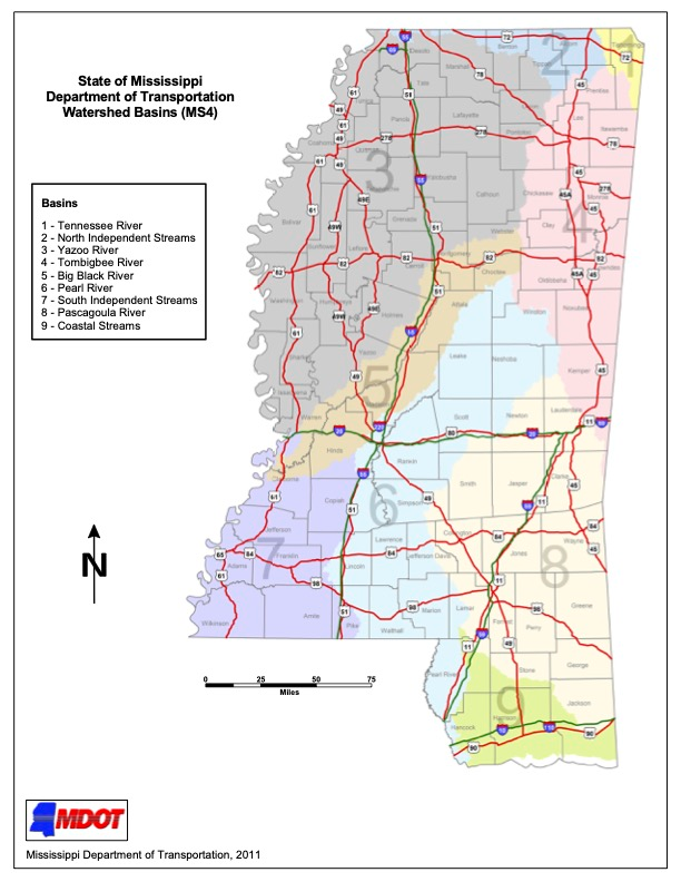
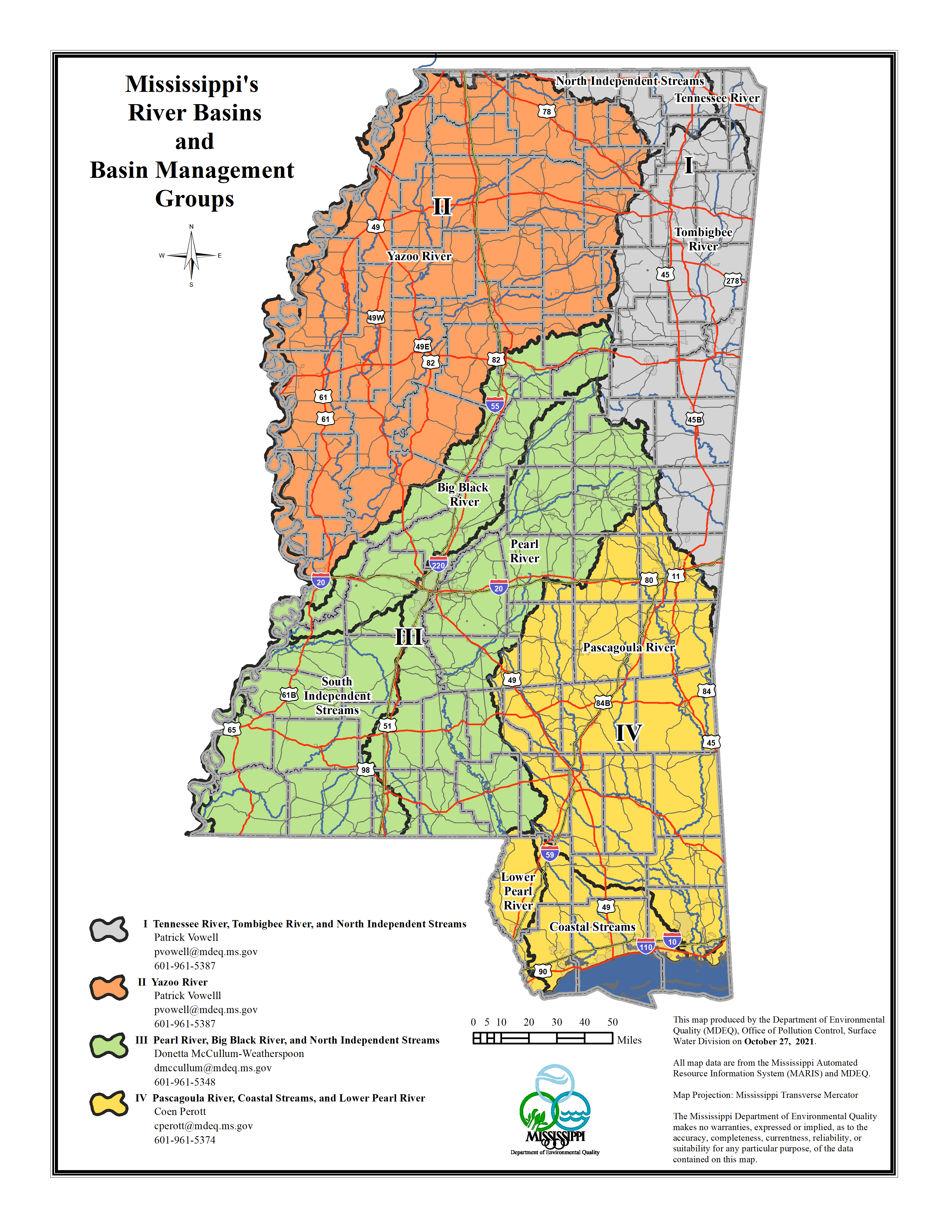
CMPDD district map courtesy of the Central Mississippi Planning and Development DistrictMap of the State of Mississippi Watershed Basins courtesy of the Misssissippi Department of Transportation.Map of the State of Mississippi’s River Basins and Basin Management Groups courtesy of Mississippi Department of Environmental Quality.
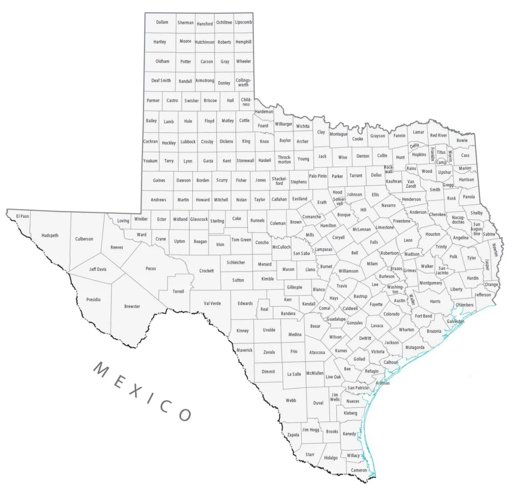
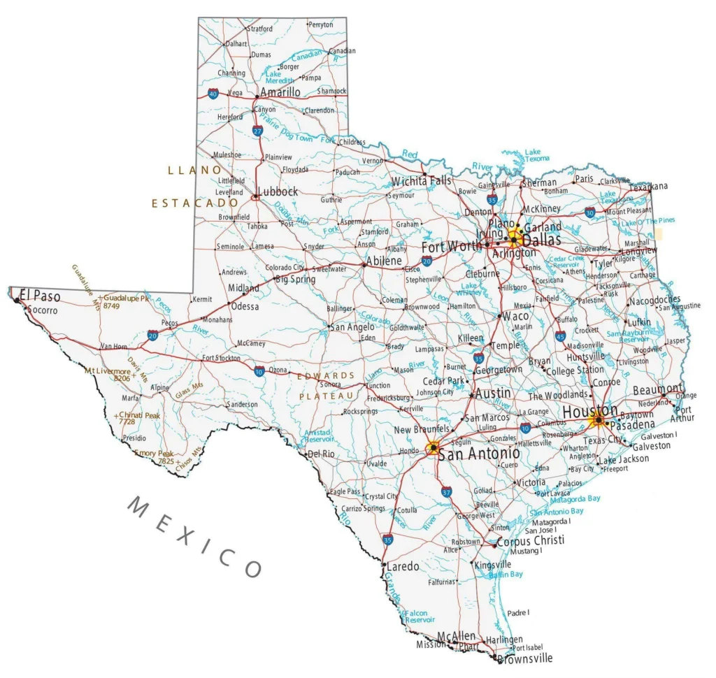
Texas State Capital Building courtesy of Wikimedia.Texas County Map courtesy of GISGeography.Map of Texas – Cities and Roads courtesy of GISGeography.Logo – Association of Texas Metropolitan Planning Organizations.Logo – Texas Association of Regional Councils
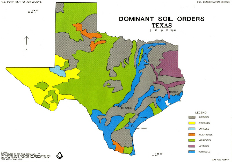
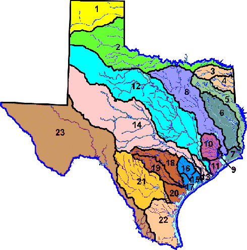
Map of Dominant Soils Order of Texas courtesy of Texas A&M AgriLife.Map of the State of Texas’ Major River and Coastal Basins of Texas courtesy of the Texas Commission on Environmental Quality.
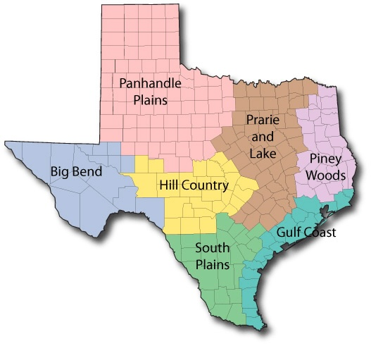
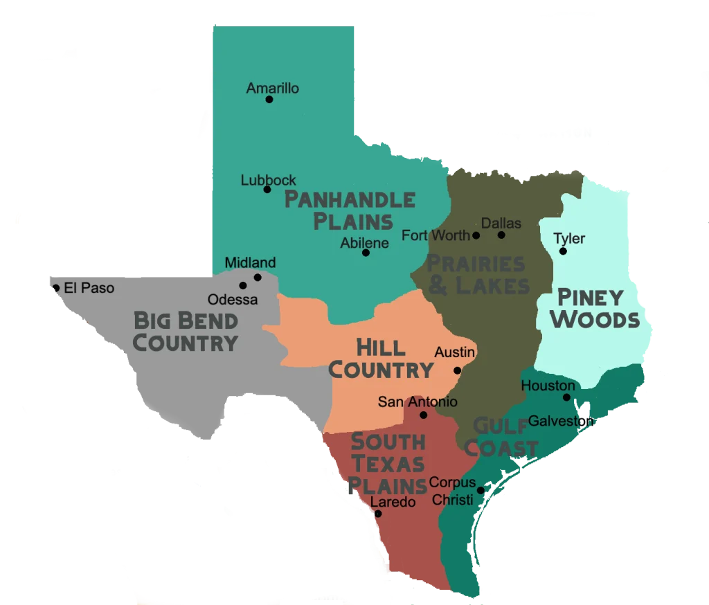
Map of Texas State Parks by cultural region courtesy of Texas State ParksMap of Texas Cultural Regions courtesy of Texaswanderes.com
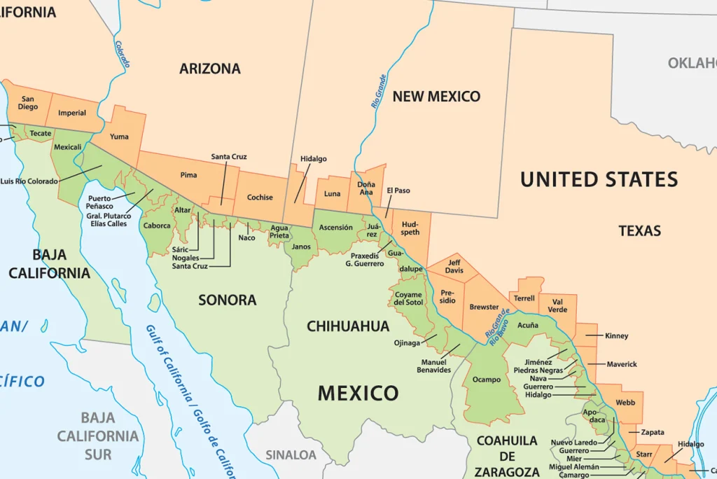
Map of the 32 Texas Border Counties served by DSHS Public Health Region courtesy of the Department of Texas Health & Human Services
Map of the 44 Counties on the U.S.-Mexico Border Region, with seven counties served by the Healthy Start Border Alliance in red courtesy of the Journal of Community Health.
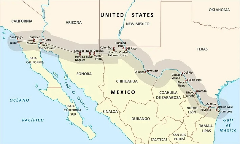
Map of communities along the United States-Mexico Border courtesy of the United States Census Bureau.
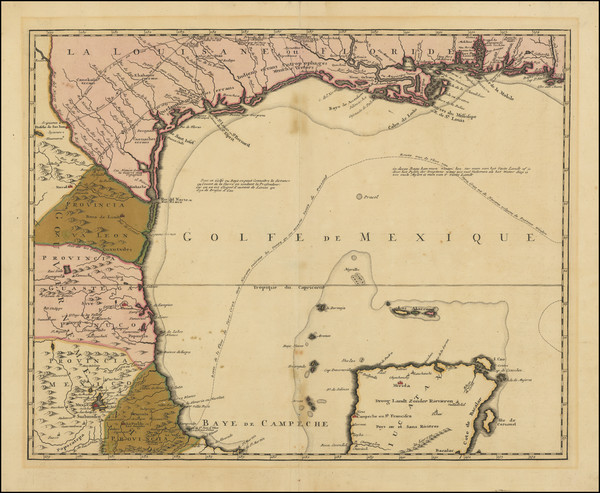
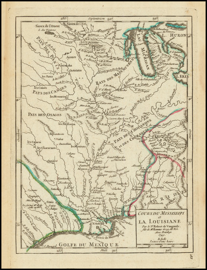
[New France] Carte de la Louisiane et du cours du Mississipi by J.F. Bernard, Amsterdam 1720. Courtesy Barry Lawrence Ruderman.A New Map of the North Parts of America claimed by France under ye Names of Louisiana, Mississipi, Canada and New France with the ye Adjoyning Territories of England and Spain by Herman Moll, London 1720 cira. Courtesy of Barry Lawrence Ruderman. [Texas, Louisiana, Gulf Coast & Yucatan] 1740 circa map La Louisiane & Joshua Ottens, Amsterdam 1740 circa. Courtesy of Barry Lawrence Ruderman.[Louisiana/Gulf Coast] Partie de la Coste de la Louisiane et de la Floride depuis le Mississipi Jus qua St. Marc d’Apalache, Paris 1744 courtesy of Barry Lawrence Ruderman.Florida Called by ye French Louisiana & Co. by H. Moll, London 1728 courtesy of Berry Lawrence Ruderman.[French Louisiana] Cours Du Mississipi et La Louisiane by Gilles Robert de Vaugondy, Paris 1749 courtesy of Barry Lawrence Ruderman.[French Louisiana] Carte De la Louisiane par Le Sr. D’Anville Dresse en Mai 1732. Publiee en 1752. Courtesy of Barry Lawrence Ruderman.
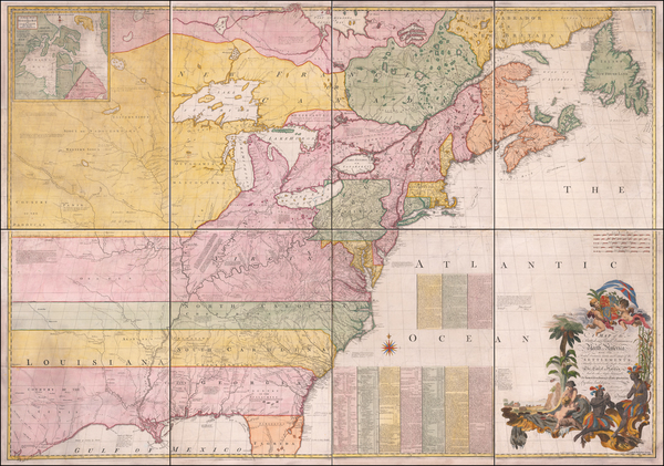
[French and English Villages and Establishments] Amerique Septentrionale avec les Routes, Distances en miles, Villages et Etablissements Francois et Anglois Par le Docteur Mitchel Traduit de I’Anglois by John Mitchell and George-Louis Le Rouge, Paris 1755. Courtesy Barry Lawrence Ruderman.A Map of the British and French Dominions in North America with the Roads, Distances, Limits and Extent of the Settlements by John Mitchell, London 1755-1757. Courtesy of Barry Lawrence Ruderman.Carte de la Louisiane et Pays Voisins . . . by Jacques Nicolas Bellin, Paris 1757. Courtesy of Barry Lawrence Ruderman.
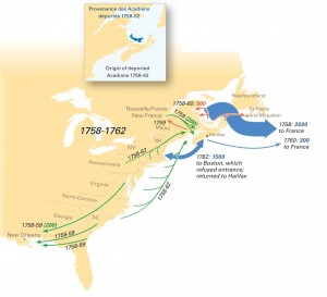
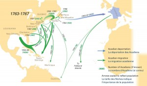
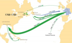
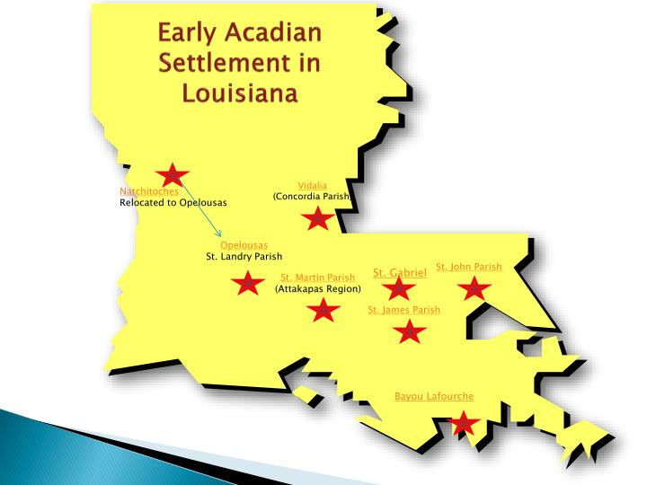
Map of Acadian Deportation, Migration, and Resettlement courtesy of the University of MaineMap of Acadian Deportation, Migration, and Resettlement courtesy of the University of Maine.Map of the Acadian Deportation, Migration, and Resettlement courtesy of the University of Maine.Map of early Acadian settlements in Louisiana courtesy Ayoka Lolovivi.
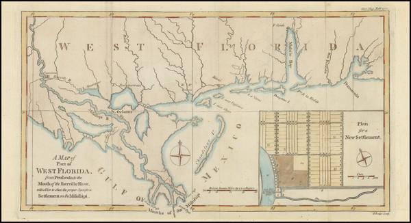
Louisiana, as formerly claimed by France, now containing part of British America to the East & Spanish America to the West of the Mississipi by London Magazine, London 1765. Courtesy of Barry Lawrence Ruderman.A Map of Part of West Florida from Pensacola to Mouth of the Iberville River by Gentleman’s Magazine, London 1772. Courtesy of Barry Lawrence Ruderman.[The Old Northwest Territory] II Paese De Selvaggi Outagamiani Mascoutesnsi Illinesi E parte Dell VI Naxiono by Antonio Zatta, Venice 1778 courtesy of Barry Lawrence Rudermand.Map of Louisiana, D’Anville’s Atlas, London 1788. Courtesy of Barry Lawrence Ruderman.
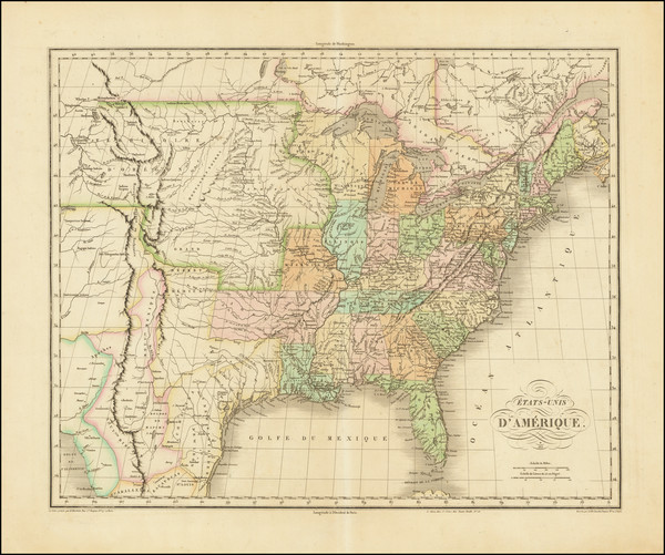
[United States] Etats-Unis de I’Amerique by Jean Alexandre Buchon, Paris 1825. Courtesy of Barry Lawrence Ruderman.
1837 map of the United States with recent counties, cities, villages and improvements in the Western States by Charles P. Varle and J.L. Woodbridge, New York, courtesy of the Barry Lawrence Ruderman.
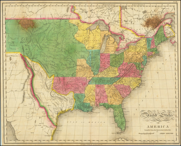
Mitchell’s National Map of the American Republic or United States of North America, by Samuel Augustus Mitchell, Philadelphia, courtesy of Barry Lawrence Ruderman.
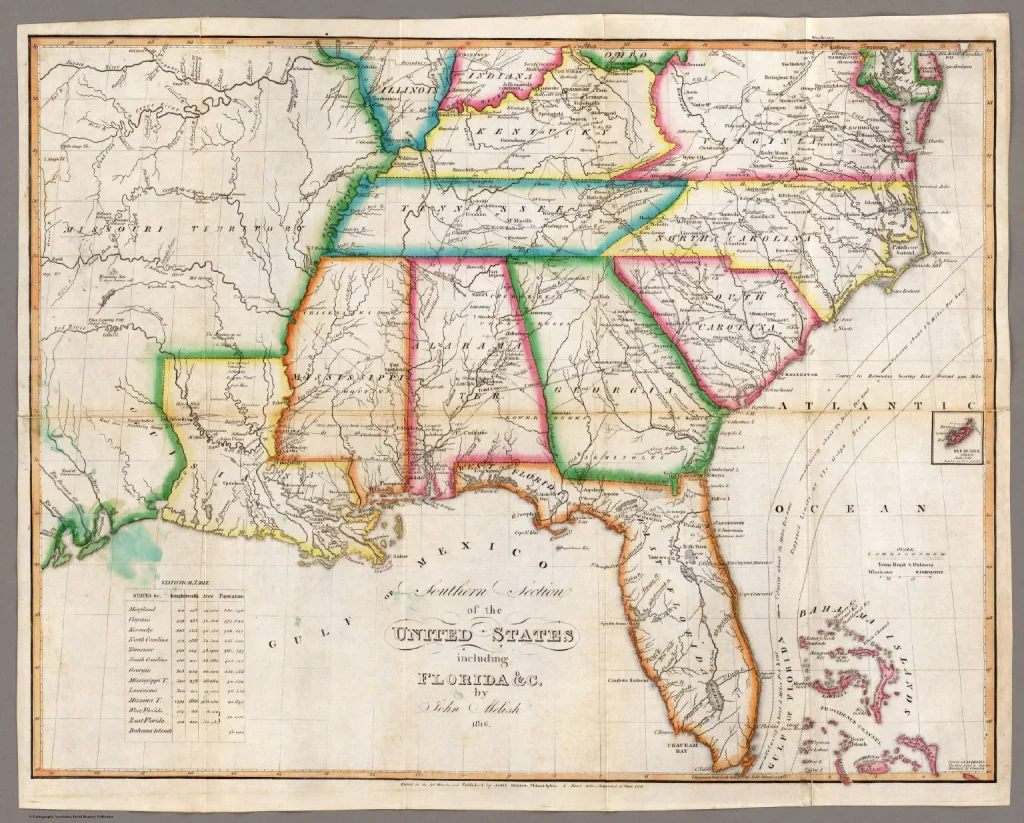
Map of New Orleans and Adjacent Country by John Melish, Philadelphia 1815. Courtesy of Barry Lawrence Ruderman.A Map of the State of Louisiana and Mississippi Territory by William Darby and John Melish, 1816. Courtesy of David Rumsey Collection.New and Improved Map of Louisiana Compiled From the Latest and Most Authentic Surveys, Both Public and Private by G.W.R. Bayley, Civil Engineer, New Orleans 1853. Courtesy of Barry Lawrence Ruderman.Map of the Southern Section of the United States including Florida&c. by John Melish, 1815 Philadelphia courtesy of David Rumsey.1855 State of Louisiana by Joseph Hutchins Colton courtesy of Barry Lawrence Ruderman.
1813 Southern United States, including Spanish East and West Floridas and the Bahama Islands, Showing the Seat of War, In the Department by John Melish. Courtesy of Barry Lawrence Ruderman.1816 Mississippi Territory courtesy of Richard Sevier.1817Map of State of Mississippi and Alabama Territory by Francis Shallus. Courtesy of Library of Congress.1856 State of Mississippi by Joseph Hutchins Colton, New York 1856 courtesy of Barry Lawrence Ruderman.
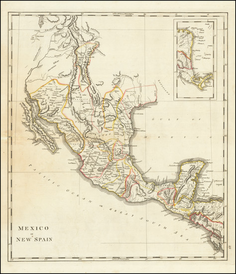
Map of Mexico or New Spain published in the midst of the Mexico’s War of Independence (1809-1821), including Texas and New Mexico left blank, by Mathew Carey, Philadelphia 1814 courtesy of Barry Lawrence Ruderman.United States of America by John Melish, Philadelphia 1822. Courtesy of Barry Lawrence Ruderman.United States and Additions by John Thomson, Edinburgh 1832. Courtesy of Barry Lawrence Ruderman.A New Map of Texas, with the Contguous American & Mexican States by Samuel Augustus Mitchell and J.H. Young, Philadelphia 1835. Courtesy of Barry Lawrence Ruderman.Map of the Republic of Texas by David H. Burr, New York 1835. Courtesy of David Rumsey Collection.Map of Texas with Parts of Adjoining States by Stephen F. Austin and Henry Schenck Tanner, 1836 Philadelphia courtesy of Wikicommons.
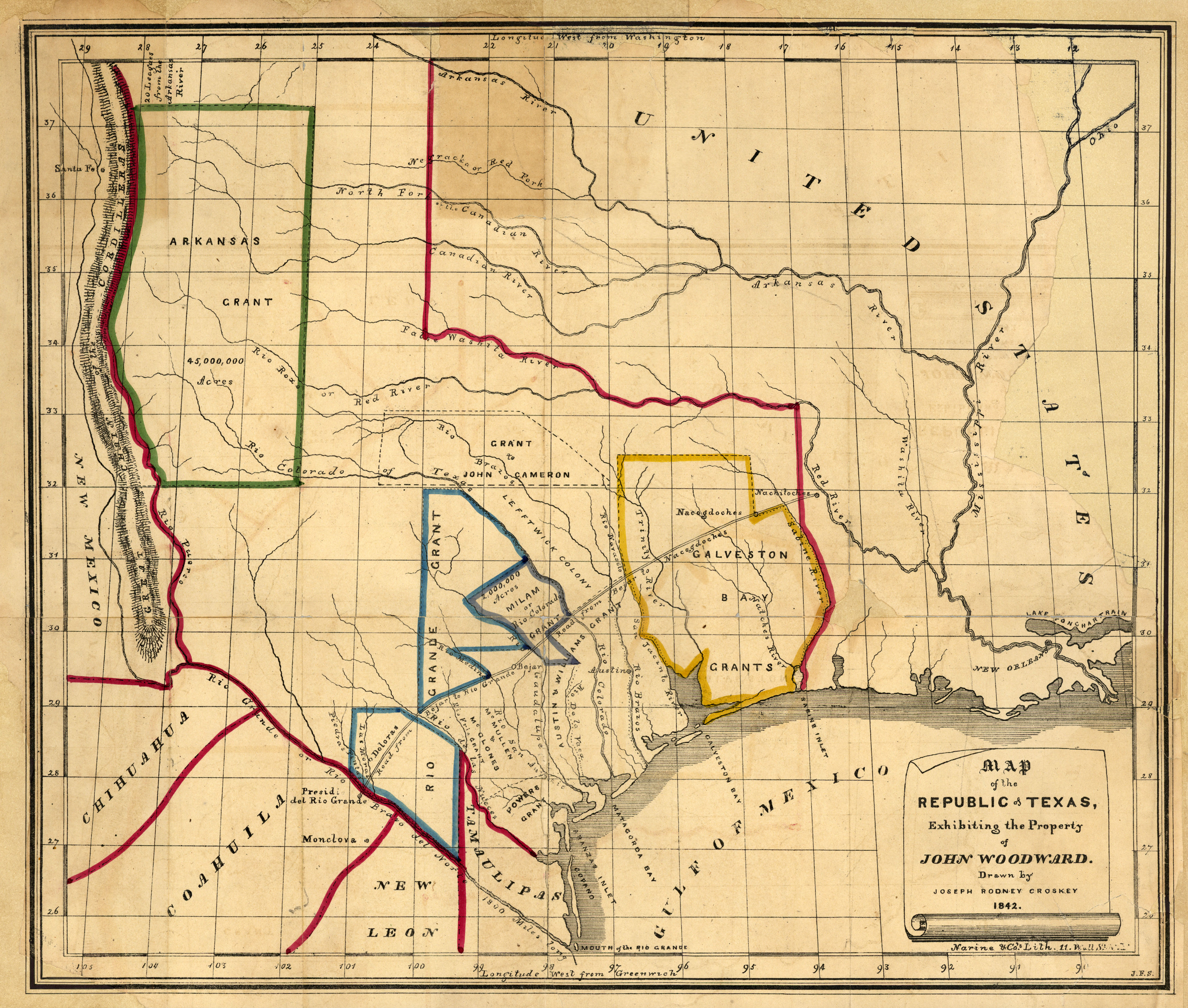
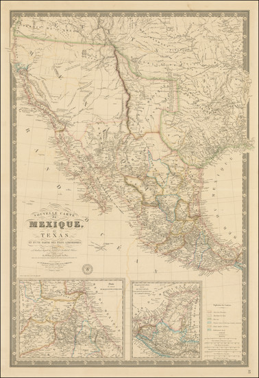
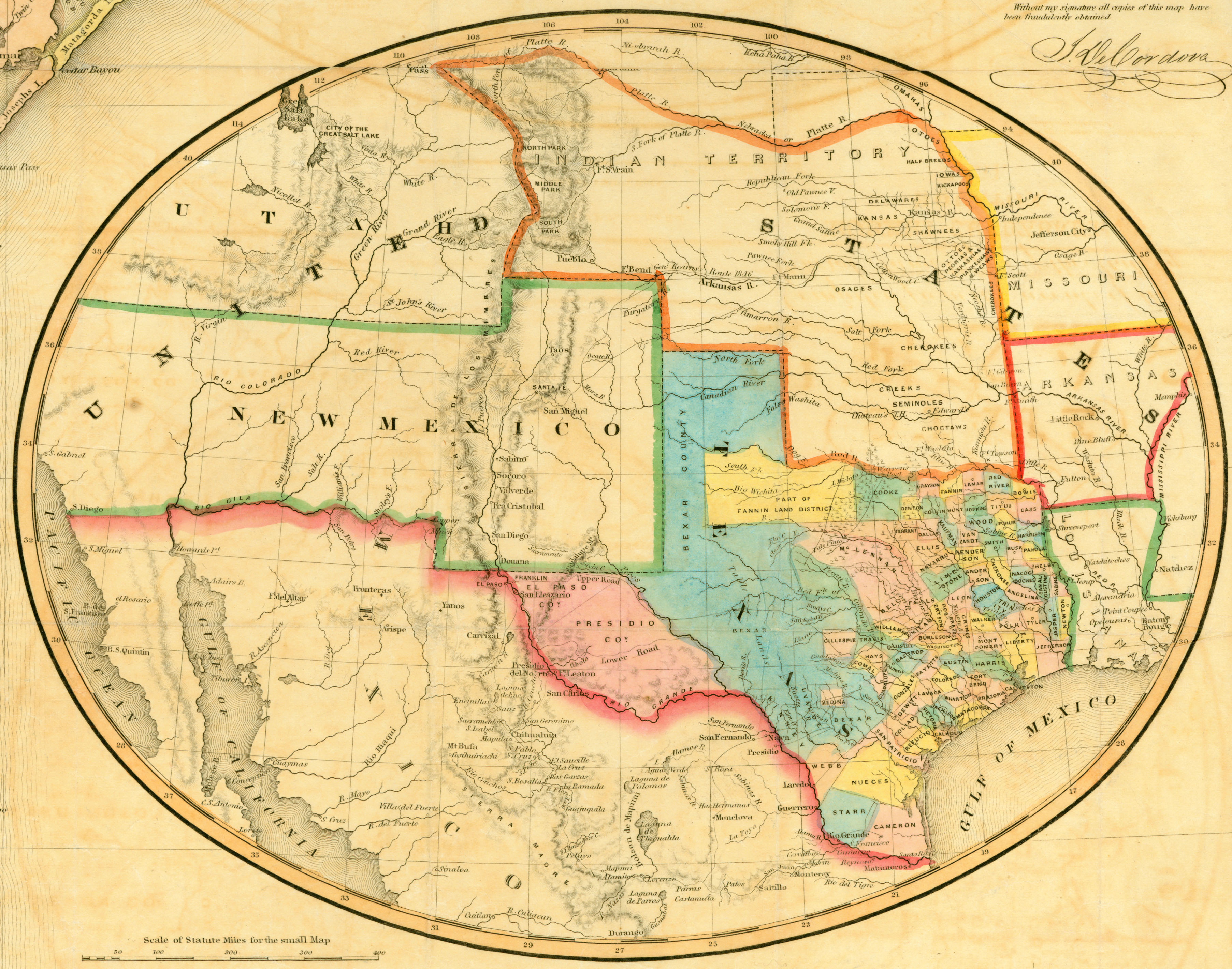
Map of the Republic of Texas, Exhibiting the Property of John Woodward by Joseph Rodney Croskey 1842. Courtesy of Dorothy Sloan-Rare Books, Austin, Texas, and Perry-Castaneda Library University of Texas at Austin.Nouvelle Carte De Mexique, Du Texas Et D’Une Partie Des Etats Limitrophes . . . 1845 (Republic of Texas) by Adrien- Hubert Brue’, Paris 1845 courtesy by Barry Lawrence Ruderman.Map of the State of Texas Compiled from the Records of the General Land Office Of the State by Robert Creuzbaur, Houston 1851. Courtesy of Dorothy Sloan-Rare Books, Austin, Texas, and the Perry-Castaneda Library, University of Texas at Austin.1855 State of Texas by J.H. Colton courtesy of David Rumsey Collection.
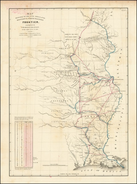
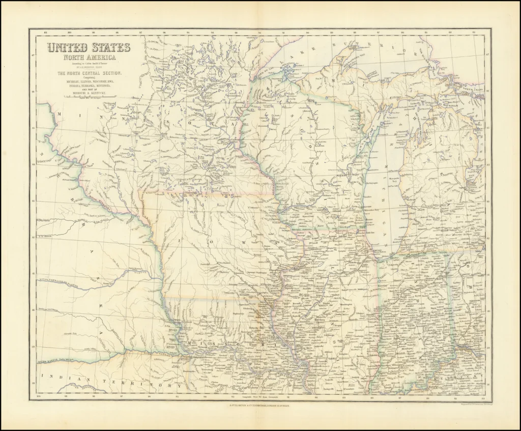
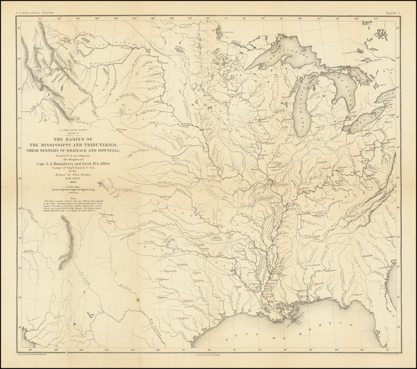
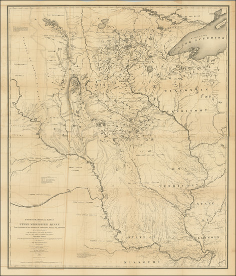
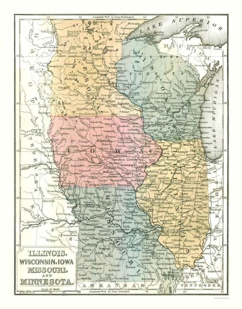
A map of a portion of Indian Country Lying East and West of the Mississippi River To the Forty Sixth Degree of North Latitude From Personal ObservationMade in Autumn of 1835 and Recent Authentic Documents by George Featherstonhaugh, Washington 1836 courtesy Barry Lawrence Ruderman.Map illustrating the plan of the defenses of the Western & North-Western Frontier, as proposed by Charles Gratiot in his report of Oct. 31, 1837 by Washington Hood, United States GPO, Washington 1837 courtesy of Barry Lawrence Ruderman.United States North America According to Calvin Smith & Tanner . . . North Central Section. Comprising Michigan, Illinois, Wisconsin, Iowa, Indiana, Nebraska, Minnesota by Archibald Fullarton & Co., Edinburgh 1855. Courtesy of Barry Lawrence Ruderman.The Basins of the Mississippi and Tributaries, Their Systems of Drainage and Downfall. Prepared to accompany the Report of Capt. A.A. Humphreys and Lieut. H.L. Abbot Corps of Top’l Eng’rs U.S.A to the Bureau of Topl. Engrs. War Dept., Washington D.C. 1861. Courtesy of Barry Lawrence Ruderman.
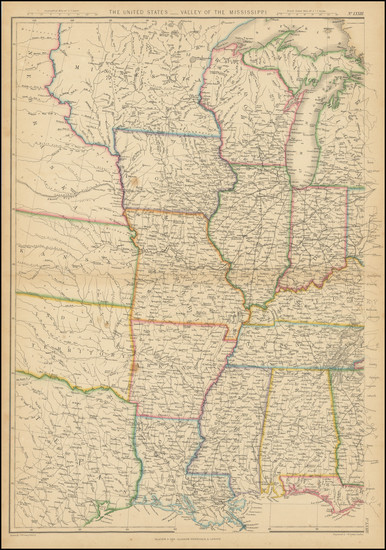
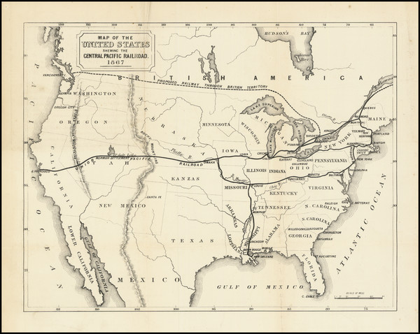
The United States – Valley of the Mississippi by Blackie & Son, Edingurgh 1875 circa. Courtesy of Barry Lawrence Ruderman.Map of the United States Showing the Central Pacific Railway by Cusack Patrick Roney, London 1868. Courtesy of Barry Lawrence Ruderman.Map of the United States North Midwest by Mitchell 1869 courtesy of mapsofthepast.
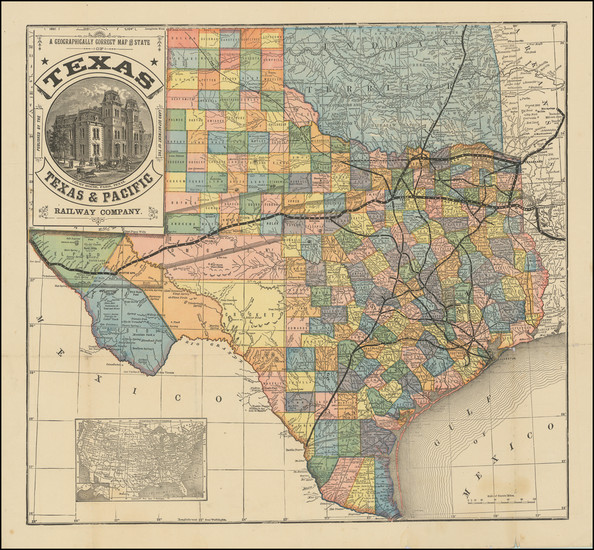
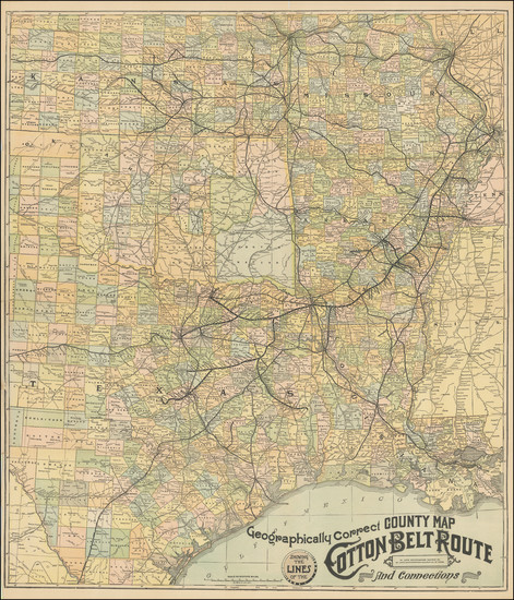
[Texas] A Geographically Correct Map of the State of Texas Published by the Land Department of Texas and Pacific Railway Company by Woodward, Tiernan & Hale, St. Louis 1881 circa. Courtesy of Barry Lawrence Ruderman.[Texas, etc.] Geographically Correct Map Showing the lines of the Cotton Belt Route and Connections by St. Louis Southwestern Railway, St. Louis 1900 Circa. Courtesy of Barry Lawrence Ruderman.Railroad Map of Texas by Ira D. Dodge, Dallas 1926. Courtesy of the Library of Congress.
Appendix C. Gulf of Mexico. Proposed Intercoastal Canal by John H. Morgan, Norris Peters Co., Circa 1905. Courtesy of Barry Lawrence Ruderman.
Cookie Consent
We use cookies to improve your experience on our site. By using our site, you consent to cookies.


![1744 [French] map - parts of LA and FL, used by fack-law.com to reflect the 3 Gulf States' shared history.](https://fack-law.com/wp-content/uploads/2025/09/2-Mississippi-Sound-copy.webp)
![1728 [English] map of Florida, as called by French LA, used by fack-law.com to reflect the 3 Gulf States' shared history.](https://fack-law.com/wp-content/uploads/2025/06/Florida-by-Louisiana-shows-exploration-routes-from-Carolinas-into-East-Texas-copy.webp)


![1825 [French] map of U.S., used by fack-law.com to reflect the 3 Gulf States' shared history.](https://fack-law.com/wp-content/uploads/2025/06/1-Louisiana-Purchase-Good-Map-copy-1024x621.webp "[French] 1825 map of the land sold acquired by the U.S. under the Louisiana Purchase.")